


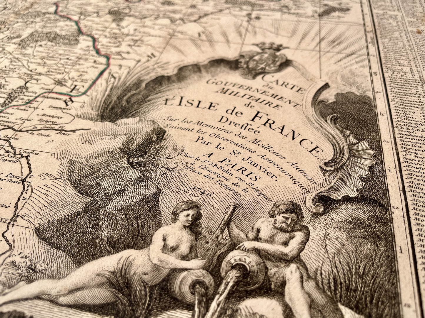
Antique map of Île-de-France by JB. Nolin - 1746
Antique map of Île-de-France by JB. Nolin - 1746
Regular price
160,00 €
Regular price
230,00 €
Sale price
160,00 €
Unit price
per
Taxes included.
Couldn't load pickup availability
This antique map of Île-de-France was produced by JB. Nolin, is dated 1746 and its size is 76x52cm. It is colored by hand and we see the cities of Paris, Versailles, Pontoise, Meaux, Sens, Mantes, Brie-Comte-Robert,...
Condition:
Moisture stains on the edges, fold in the center, tears on the edges, missing part on the bottom. Please note, my maps are old and are not always in perfect condition!


-

Secure payment
-

Careful shipping
-

No reproduction
-

Satisfied or refunded


-

“Hello, thank you for sending this, the cards are superb!”
Jean-Philippe
-
"They are very beautiful, just need to frame them! Thank you"
Baptiste
-
"Fast shipping and very good tracking."
Alice
-
"My husband loved the maps I gave him for Christmas!"
Solène
