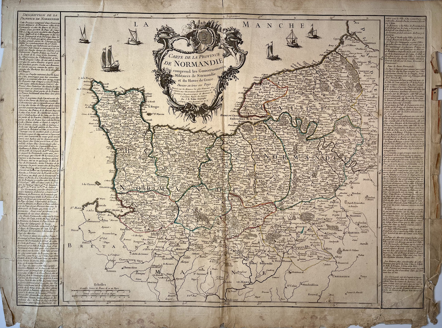
Old map of Normandy by JB. Nolin - ca. 1700
Couldn't load pickup availability
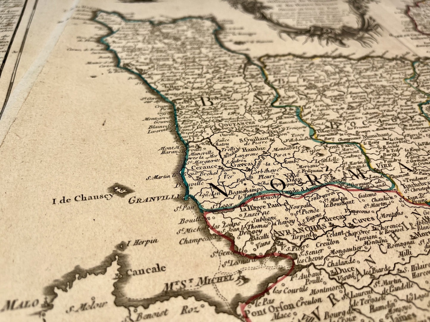
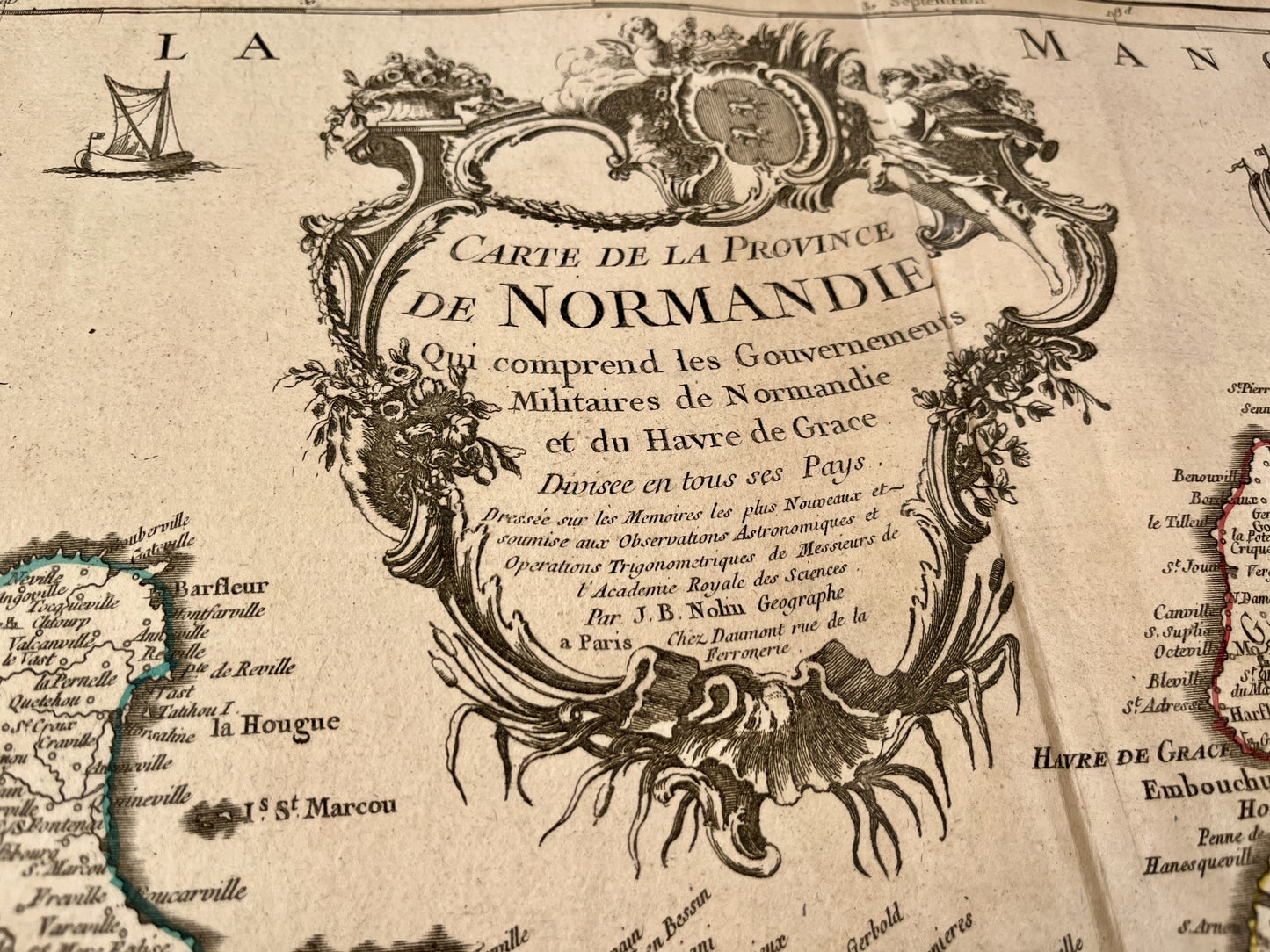
This old map of Normandy "which includes the Military Governments of Normandy and Havre de Grace, divided into all its countries" was produced by JB. Nolin, dates from the 1700s (undated) and its size is 70x52.5cm. It is colored by hand and we can see the towns of Neufchâtel, Gisors, Evreux, Le Havre, Rouen, Lisieux, Sées, Caen, Bayeux, Domfront, Avranches, Coutances, Valognes, Cherbourg,...
Condition:
Fold in the center, tears on the edges and summary repairs with adhesive tape on the back. Please note, my maps are old and are not always in perfect condition!
![Achat carte ancienne de la Normandie](http://carteancienne.com/cdn/shop/files/Achat-carte-ancienne-Normandie.jpg?v=1715072411&width=1445)
![Décoration carte géographique ancienne de la Normandie](http://carteancienne.com/cdn/shop/files/Decoration-carte-geographique-normandie.jpg?v=1715072410&width=1445)
![Carte ancienne de la Normandie avec villes et villages](http://carteancienne.com/cdn/shop/files/Carte-ancienne-normandie-villes-villages.jpg?v=1715072411&width=1445)
-
Satisfied or refunded !
You don't like the card? The return is at your expense but the card is fully refunded.
-
No reproduction!
All the cards in my collection are originals that I have found since I was very young.
-
Fast and quality shipping
Whatever the shipping method, shipments are made within 24 hours in reinforced tubes.
These old maps may interest you
-
Old illustrated cards
Discover my collection of old illustrated geographical maps. Perfect for history lovers,...
-
Old maps of France
Discover here my old maps of France. From Paris to Marseille, I...
-
Cassini maps
Discover my collection of old Cassini maps. To help you find the...