


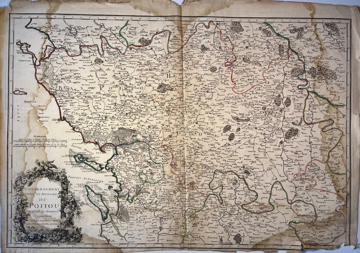
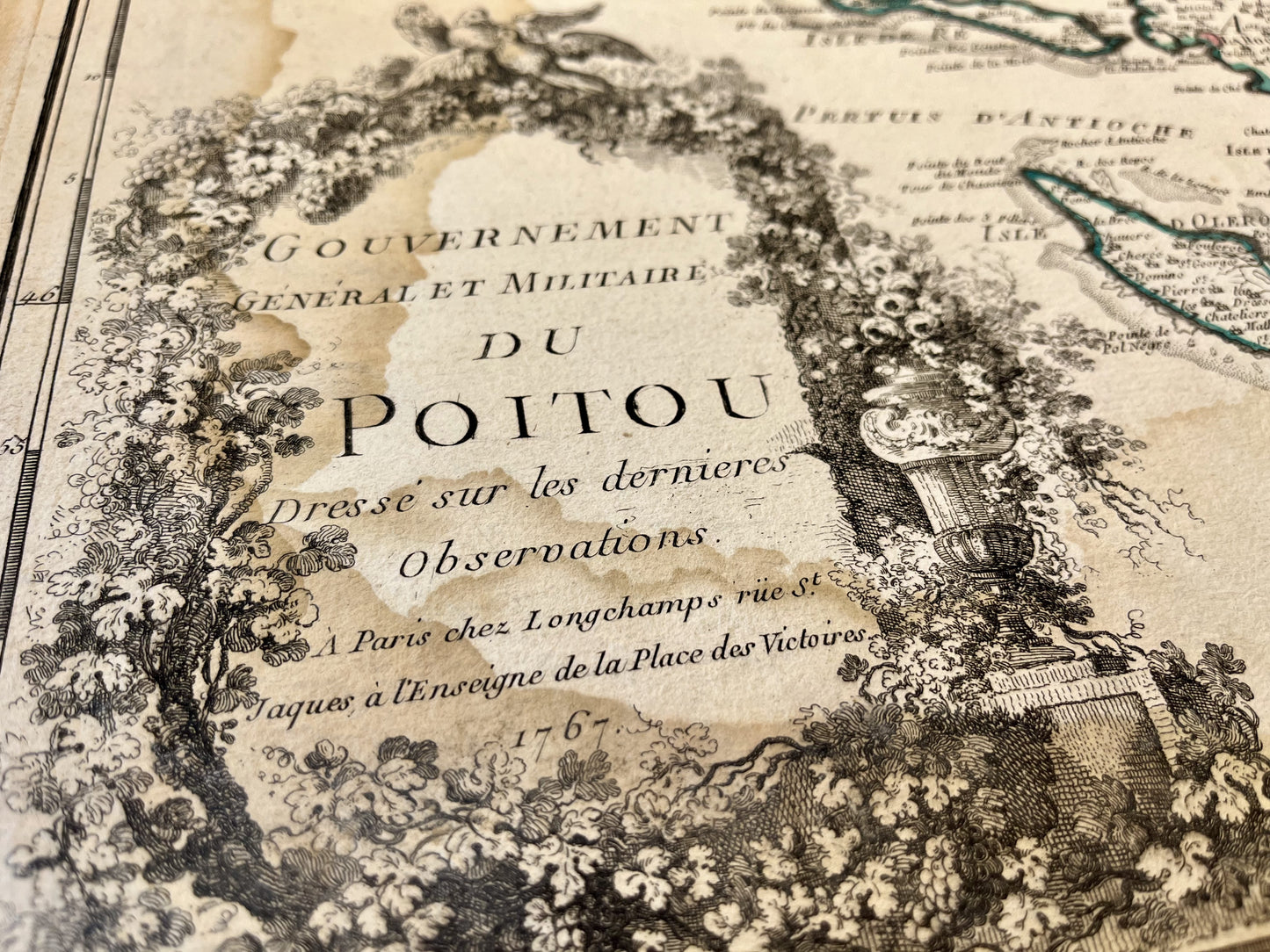
Antique map of Poitou by Longchamps - 1767
Antique map of Poitou by Longchamps - 1767
Regular price
190,00 €
Regular price
240,00 €
Sale price
190,00 €
Unit price
per
Tax included.
Couldn't load pickup availability
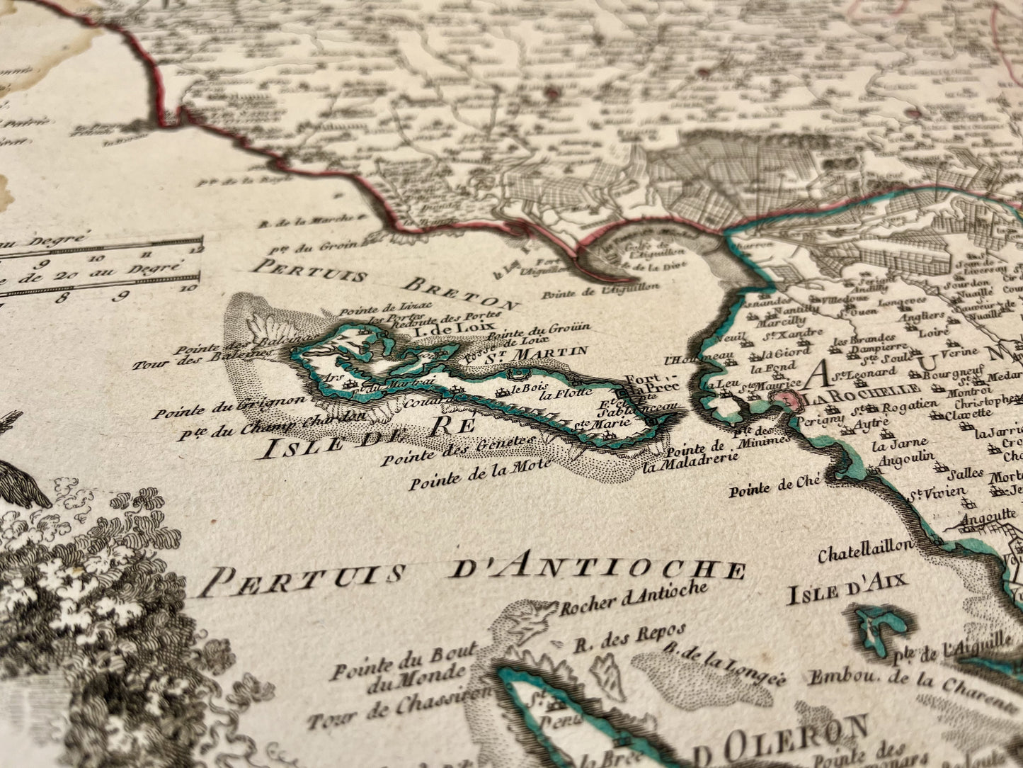
This old map of Poitou was published by Longhamps, is dated 1767 and its size is 76x53cm. It is colored by hand and we can see the towns of Poitiers, Montmorillon, Chauvigny, Loudun, Niort, Saintes, les Sables-d'Olonne, Mortagne, la Rochelle,... And the islands of Oléron, Ré, Yeu and Noirmoutier.
Condition:
Moisture stains on the edges, fold in the center, tears on the edges, missing card on the bottom. Please note, my maps are old and are not always in perfect condition!
-

Paiement sécurisé
-

Envoi soigné
-

Aucune reproduction
-

Satisfait ou remboursé


