


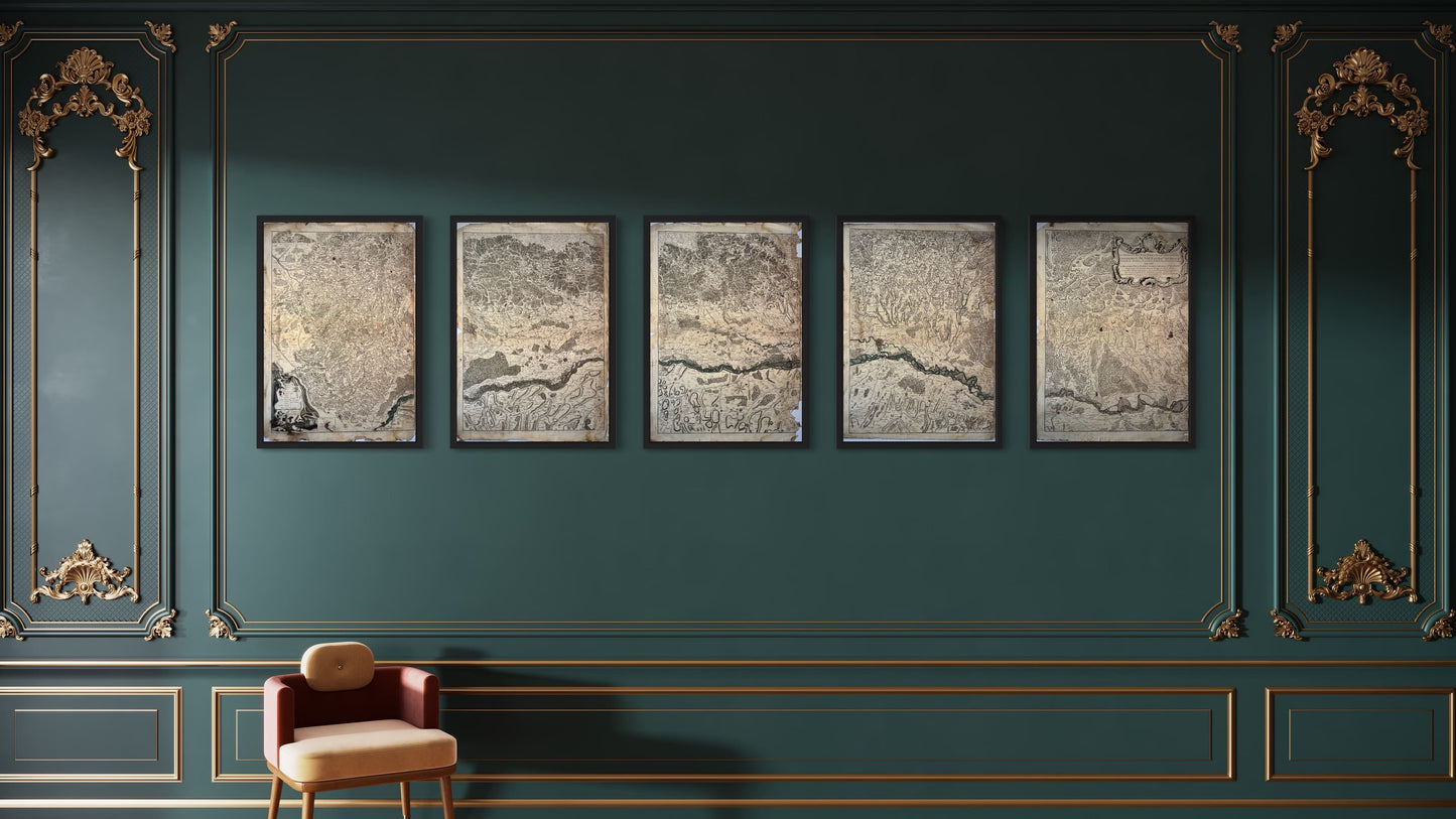
Antique map of the course of the Rhine from Basel to Hert in five parts by GL. Le Rouge - 1745
Antique map of the course of the Rhine from Basel to Hert in five parts by GL. Le Rouge - 1745
Couldn't load pickup availability
This old map of the course of the Rhine from "Basel to Hert near Philisburg containing Alsace and part of Brisgau" was produced by GL. Le Rouge, is dated 1745 and the size of each sheet is approximately 77x54cm, giving a total size of 77x270cm. It is partially colored by hand, decorated with a very beautiful cartouche and we see the cities of Basel, Mulhouse, Altkirch, Gebweiller, Rufach, Fribourg, Neuf-Brisach, Colmar, Selestat, Strasbourg, Lauterbourg,...
Condition:
Moisture stains, tears at the edges, gaps and adhesive tape repairs in a few places. Please note, my maps are old and are not always in perfect condition, please look carefully at the photos.


-

Secure payment
-

Careful shipping
-

No reproduction
-

Satisfied or refunded


-

“Hello, thank you for sending this, the cards are superb!”
Jean-Philippe
-
"They are very beautiful, just need to frame them! Thank you"
Baptiste
-
"Fast shipping and very good tracking."
Alice
-
"My husband loved the maps I gave him for Christmas!"
Solène
