


Old nautical chart of the Bays of Briande, Bon-Porté and Pampelonne
Old nautical chart of the Bays of Briande, Bon-Porté and Pampelonne
Regular price
75,00 €
Regular price
Sale price
75,00 €
Unit price
per
Taxes included.
Couldn't load pickup availability
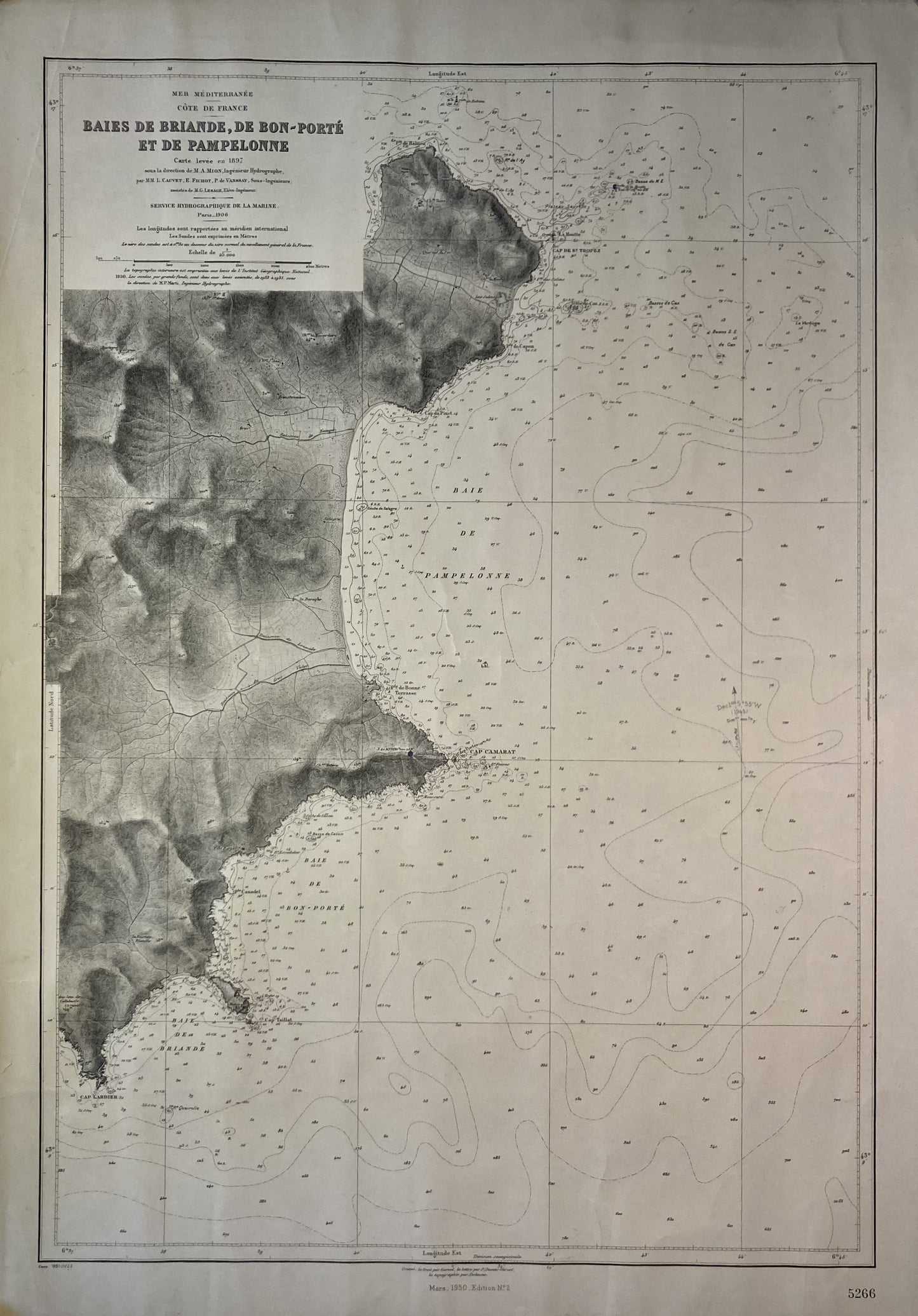
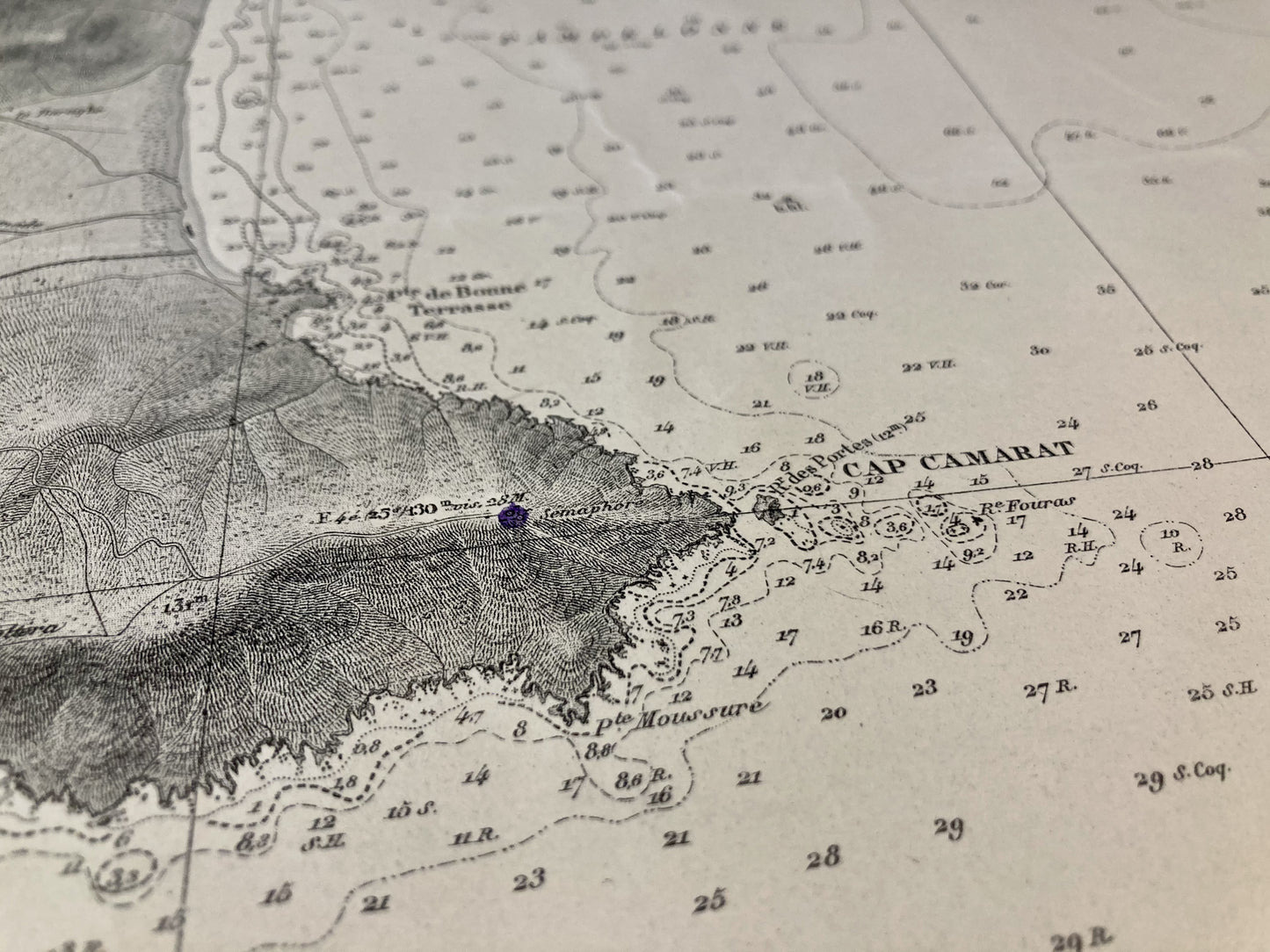
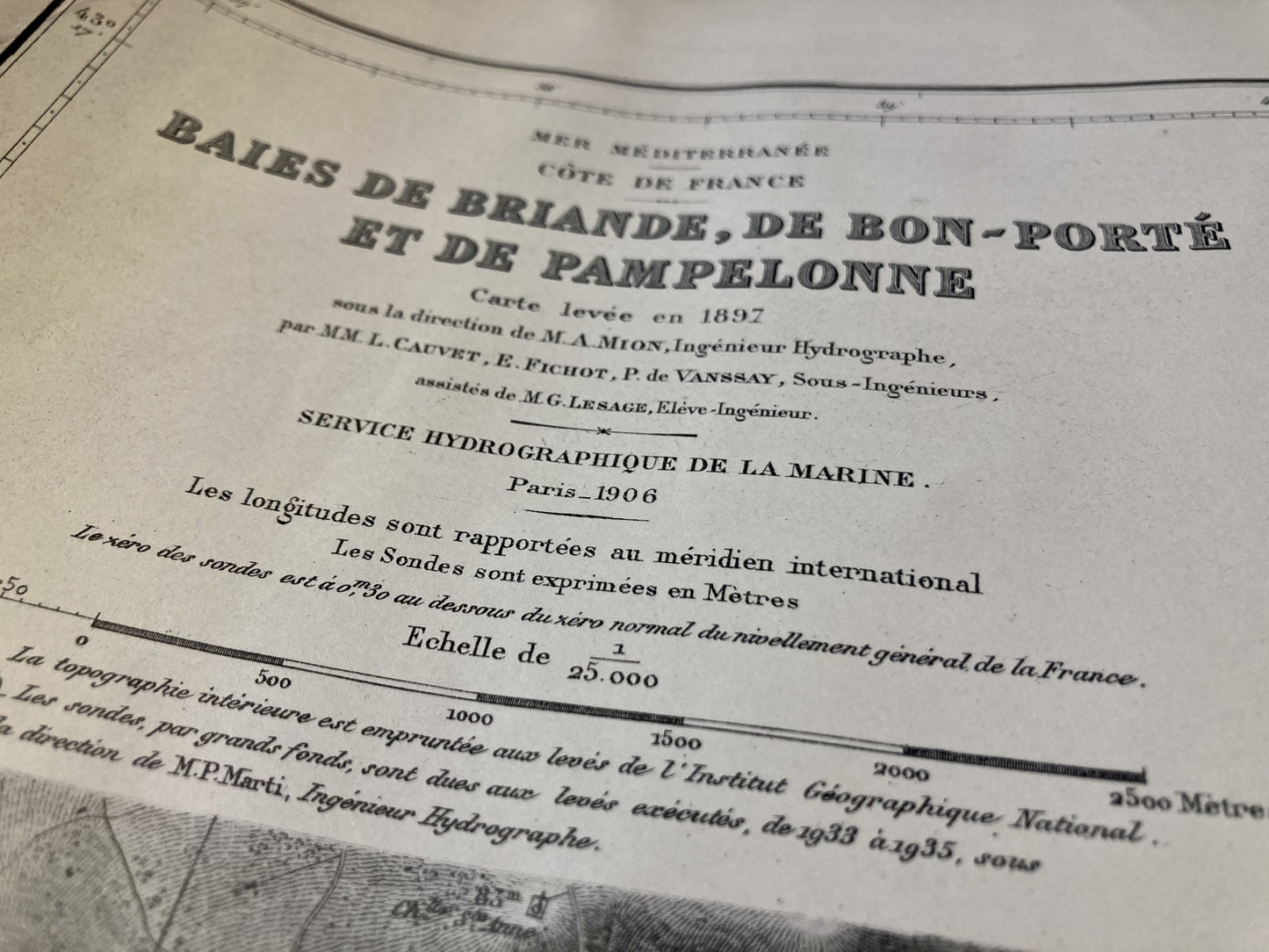
This old nautical chart representing the Bays of Briande, Bon-Porté and Pampelonne, was produced by the Service Hydrographique de la Marine, ancestor of SHOM. Its dimension is 75x53cm.
Condition:
Minimal folds, stains and tears. Please note, my maps are old and are not always in perfect condition!
-

Secure payment
-

Careful shipping
-

No reproduction
-

Satisfied or refunded


-

“Hello, thank you for sending this, the cards are superb!”
Jean-Philippe
-
"They are very beautiful, just need to frame them! Thank you"
Baptiste
-
"Fast shipping and very good tracking."
Alice
-
"My husband loved the maps I gave him for Christmas!"
Solène
