


Old nautical chart of Belle-Île - Rade du Palais
Old nautical chart of Belle-Île - Rade du Palais
Regular price
60,00 €
Regular price
Sale price
60,00 €
Unit price
per
Taxes included.
Couldn't load pickup availability
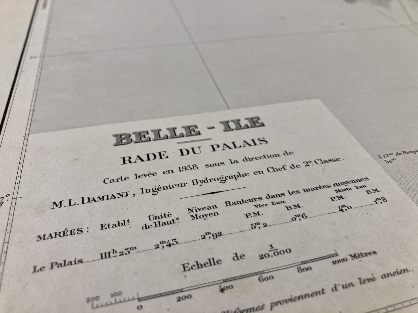
This old nautical chart representing the Rade du Palais in Belle-Île, was produced by the Marine Hydrographic Service, ancestor of SHOM. It dates from the middle of the 20th century and its size is 70x48cm.
Condition:
Minimal stains. Please note, my maps are old and are not always in perfect condition!
List of towns and villages represented:
The Palace, Port-Salio, Samzun, Kerdonis, Arnaud, Sauzon


-

Secure payment
-

Careful shipping
-

No reproduction
-

Satisfied or refunded


-

“Hello, thank you for sending this, the cards are superb!”
Jean-Philippe
-
"They are very beautiful, just need to frame them! Thank you"
Baptiste
-
"Fast shipping and very good tracking."
Alice
-
"My husband loved the maps I gave him for Christmas!"
Solène
