Old nautical chart from Croisic to Pointe de Saint-Gildas
Old nautical chart from Croisic to Pointe de Saint-Gildas
Couldn't load pickup availability
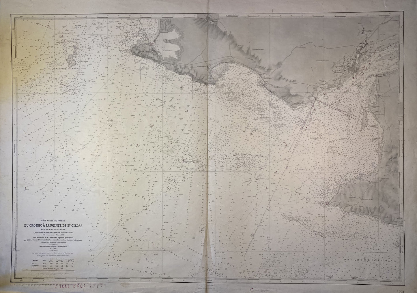
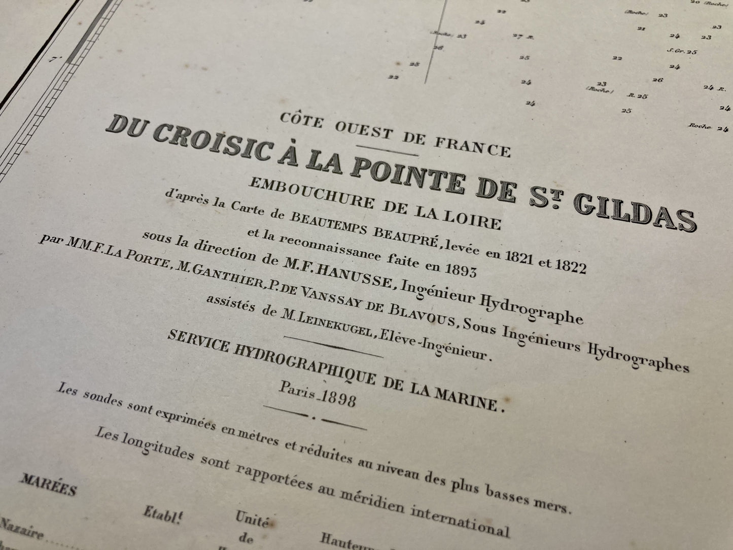
This old nautical chart representing the West Coast of France, from Croisic to Pointe de Saint-Gildas, was produced by the Service Hydrographique de la Marine, ancestor of SHOM. It dates from the middle of the 20th century and its size is 105x75cm.
Condition:
Fold in the center, small writing and minimal tears on the edges. Please note, my maps are old and are not always in perfect condition!
List of towns and villages represented:
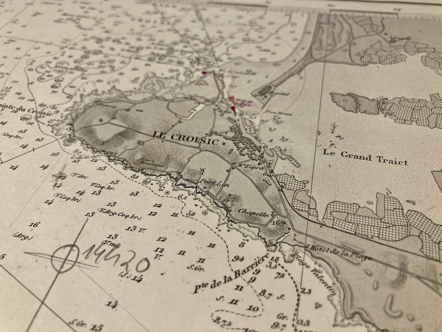
Saint-Gildas, la Plaine-sur-Mer, Saint-Brévin-les-Pins, Saint-Nazaire, Pornichet, la Baule, le Pouliguen, Batz-sur-Mer, le Croisic, Guérande
-

“Hello, thank you for sending this, the cards are superb!”
Jean-Philippe
-
"They are very beautiful, just need to frame them! Thank you"
Baptiste
-
"Fast shipping and very good tracking."
Alice
-
"My husband loved the maps I gave him for Christmas!"
Solène

-

Secure payment
-

Careful shipping
-

No reproduction
-

Satisfied or refunded