


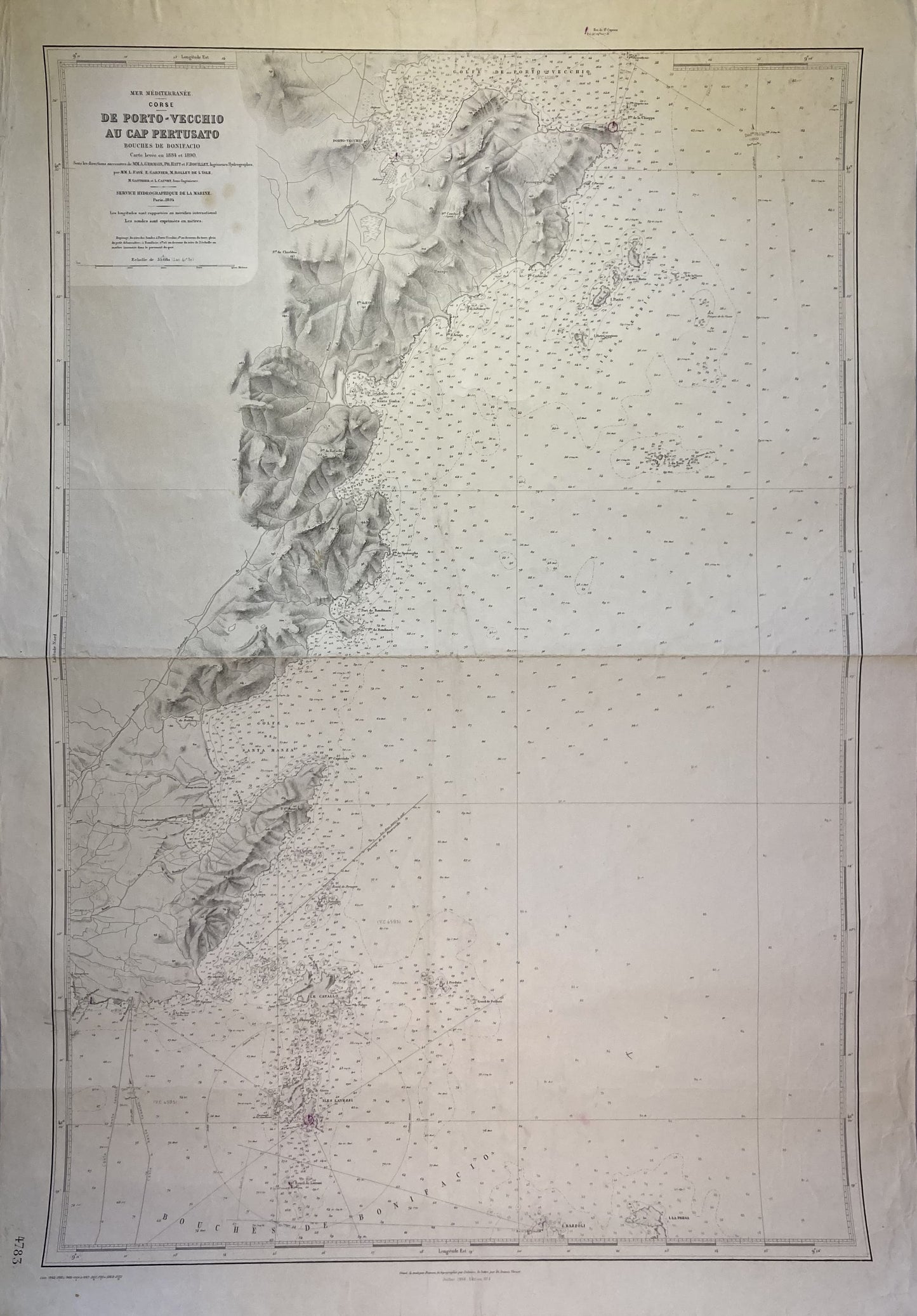
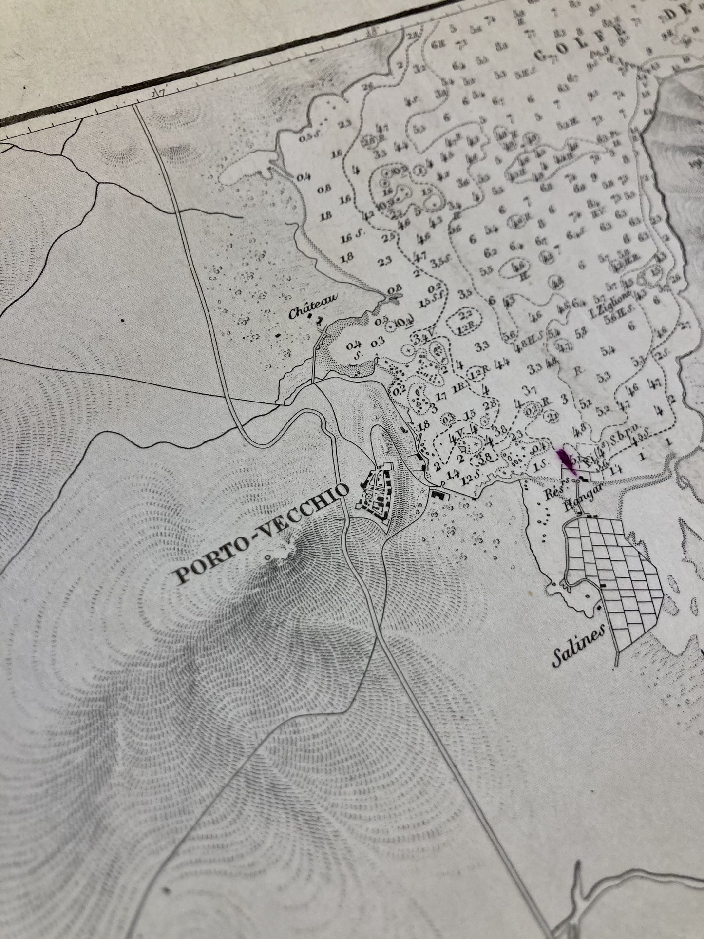
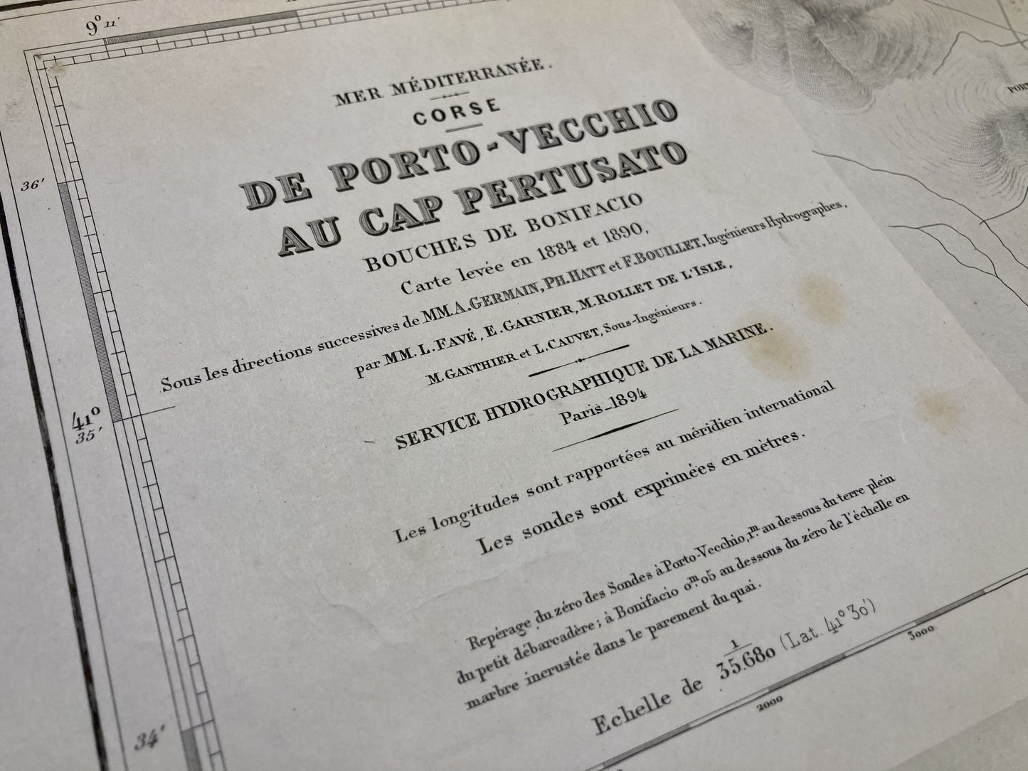
Old nautical chart from Porto-Vecchio to Cape Pertusato
Old nautical chart from Porto-Vecchio to Cape Pertusato
Regular price
65,00 €
Regular price
Sale price
65,00 €
Unit price
per
Tax included.
Couldn't load pickup availability
This old nautical chart of Corsica, from Porto-Vecchio to Cape Pertusato, was produced by the Service Hydrographique de la Marine, ancestor of the SHOM. It dates from the middle of the 20th century and its size is 105x74cm.
Condition:
Fold in the center and stains on the left edge. Please note, my maps are old and are not always in perfect condition!
-

Paiement sécurisé
-

Envoi soigné
-

Aucune reproduction
-

Satisfait ou remboursé


