


Old and monumental map of Genoa - Italy, ca. 1930
Old and monumental map of Genoa - Italy, ca. 1930
Couldn't load pickup availability
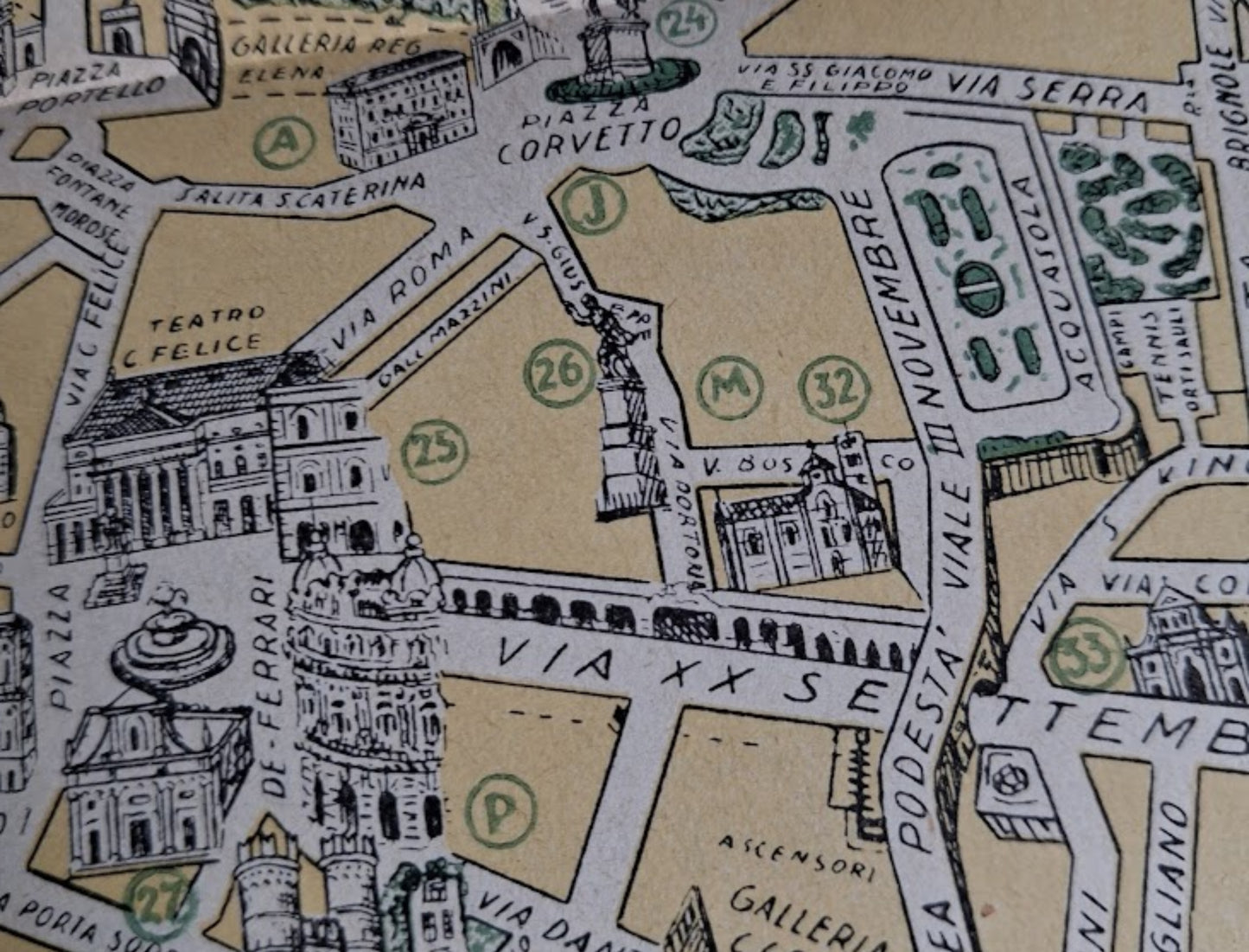
An antique, illustrated, and geographical map of the city of Genoa (GENOVA), Italy, titled "PIANTA MONUMENTALE DI GENOVA" (Municipal Map of Genoa). This vintage map highlights the city center and the port district (PORTO DI GENOVA) with great attention to architectural details and monuments. The style is a combination of precise cartography and pictorial illustrations, where the main buildings, churches, and palaces (such as the Palazzo San Giorgio or the Teatro Carlo Felice) are drawn in perspective to emphasize their importance. The map, in black and white with touches of ochre yellow for the streets and blue-green for the sea and canals, offers a detailed view of the narrow streets and urban development around the port. The bottom of the map features a comprehensive legend listing numerous numbered or lettered locations (Palazzo Ducale, Galleria Mazzini, Chiesa di S. Donato, Porta Romana). The sections of the quays, with boats and port structures (Ponte a Parodi, Ponte dei Mille), are clearly depicted. Although the exact date is not provided, the style of the map is characteristic of tourist materials from the 1920s and 1930s, a period of urban and port expansion. The map measures 35 cm by 50 cm.
Condition :
Good condition. Please note, my maps are old and not always in perfect condition!
List of the main locations represented:
Genoa (Genova), Porto, Via XX Settembre, Via Roma, Piazza De Ferrari, Teatro Carlo Felice, Via Balbi, Via del Campo, Ponte dei Mille, Via San Vincenzo, Acquasola.


-

Secure payment
-

Careful shipping
-

No reproduction
-

Satisfied or refunded


-

“Hello, thank you for sending this, the cards are superb!”
Jean-Philippe
-
"They are very beautiful, just need to frame them! Thank you"
Baptiste
-
"Fast shipping and very good tracking."
Alice
-
"My husband loved the maps I gave him for Christmas!"
Solène
