


Old map of Liège "Main Monuments and Curiosities" - ca. 1960
Old map of Liège "Main Monuments and Curiosities" - ca. 1960
Couldn't load pickup availability
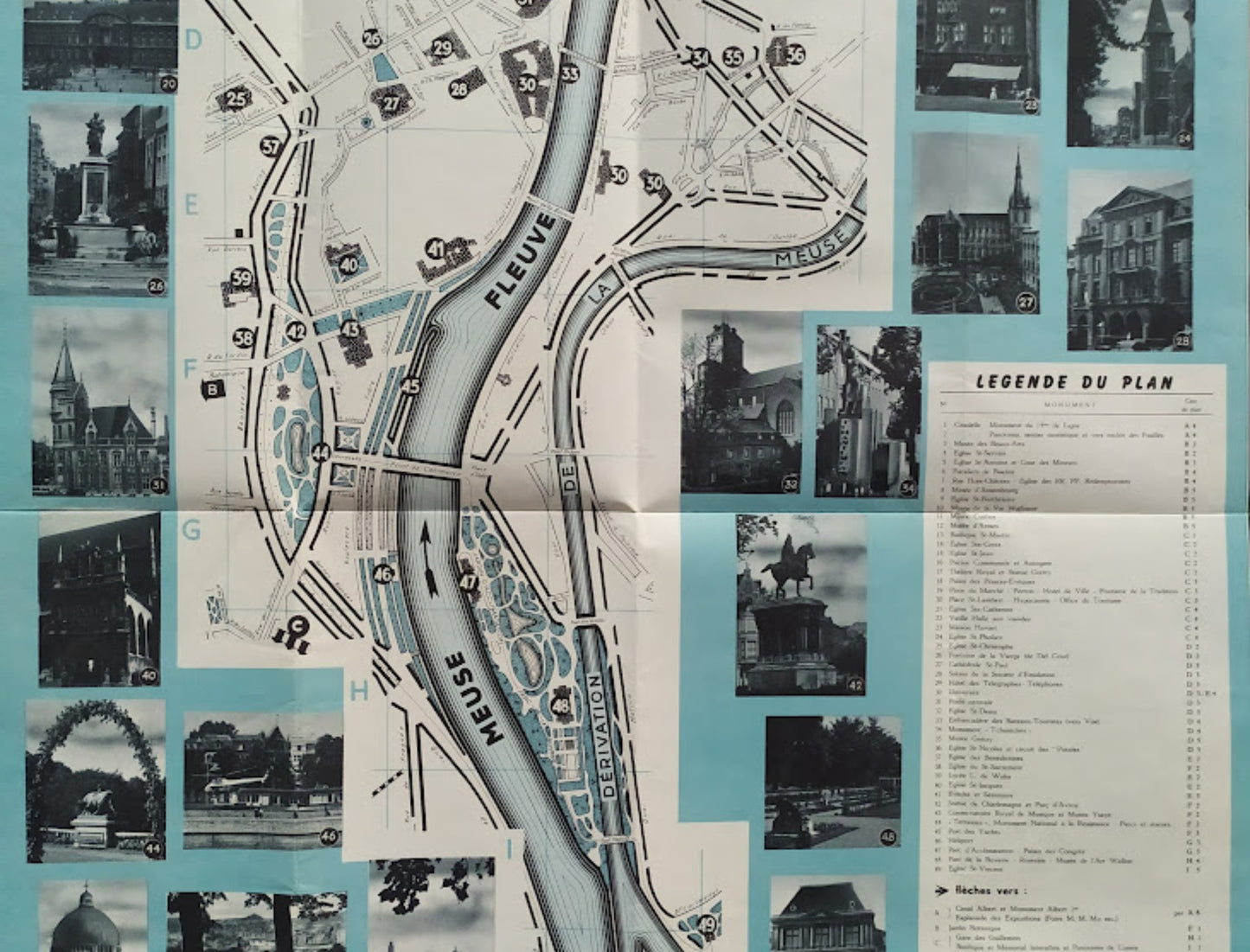
This vintage map of the city of Liège, Belgium, is a cartographic and tourist item centered on the Meuse River and its diversion. The document is distinguished by its original layout, surrounding the urban map with numerous black and white photographs illustrating the iconic monuments of the "Fiery City." A detailed legend lists 49 points of interest, including religious buildings, museums, and civic infrastructure. The graphic style, with its light blue background and precise street outlines, is characteristic of documents produced by tourist offices in the 1960s. The map mentions the Liège City Tourist Office as well as the Alderman's Office for Tourism. The map measures 58 cm by 40 cm.
Condition
Good condition. Please note, my maps are old and not always in perfect condition!


-

Secure payment
-

Careful shipping
-

No reproduction
-

Satisfied or refunded


-

“Hello, thank you for sending this, the cards are superb!”
Jean-Philippe
-
"They are very beautiful, just need to frame them! Thank you"
Baptiste
-
"Fast shipping and very good tracking."
Alice
-
"My husband loved the maps I gave him for Christmas!"
Solène
