


Map of Avignon – 1920s
Map of Avignon – 1920s
Couldn't load pickup availability
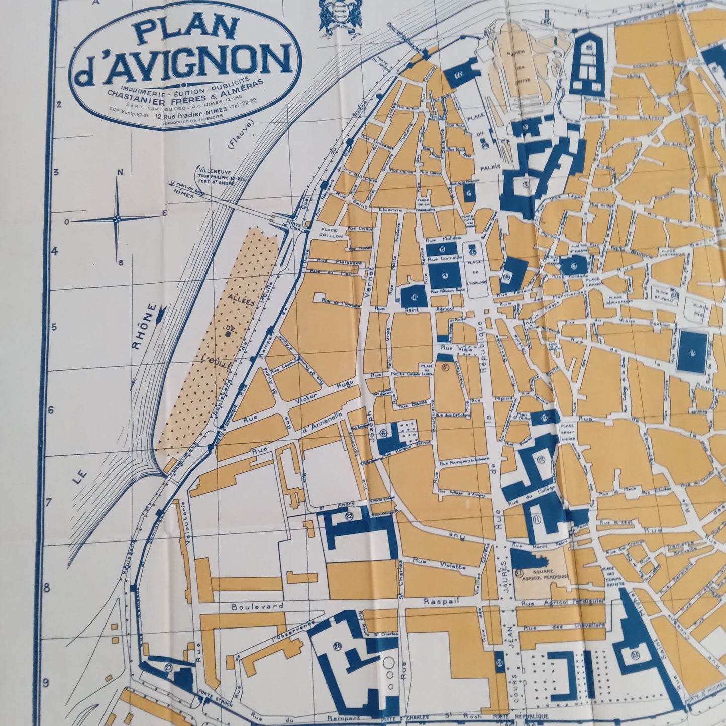
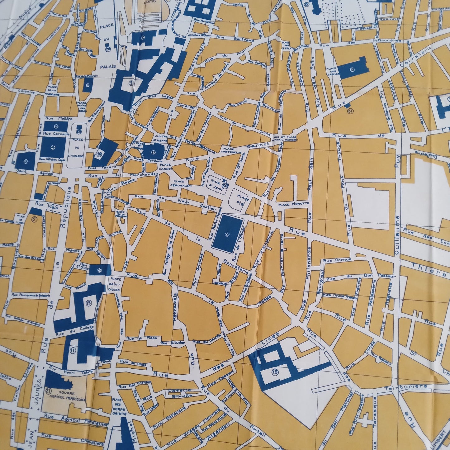
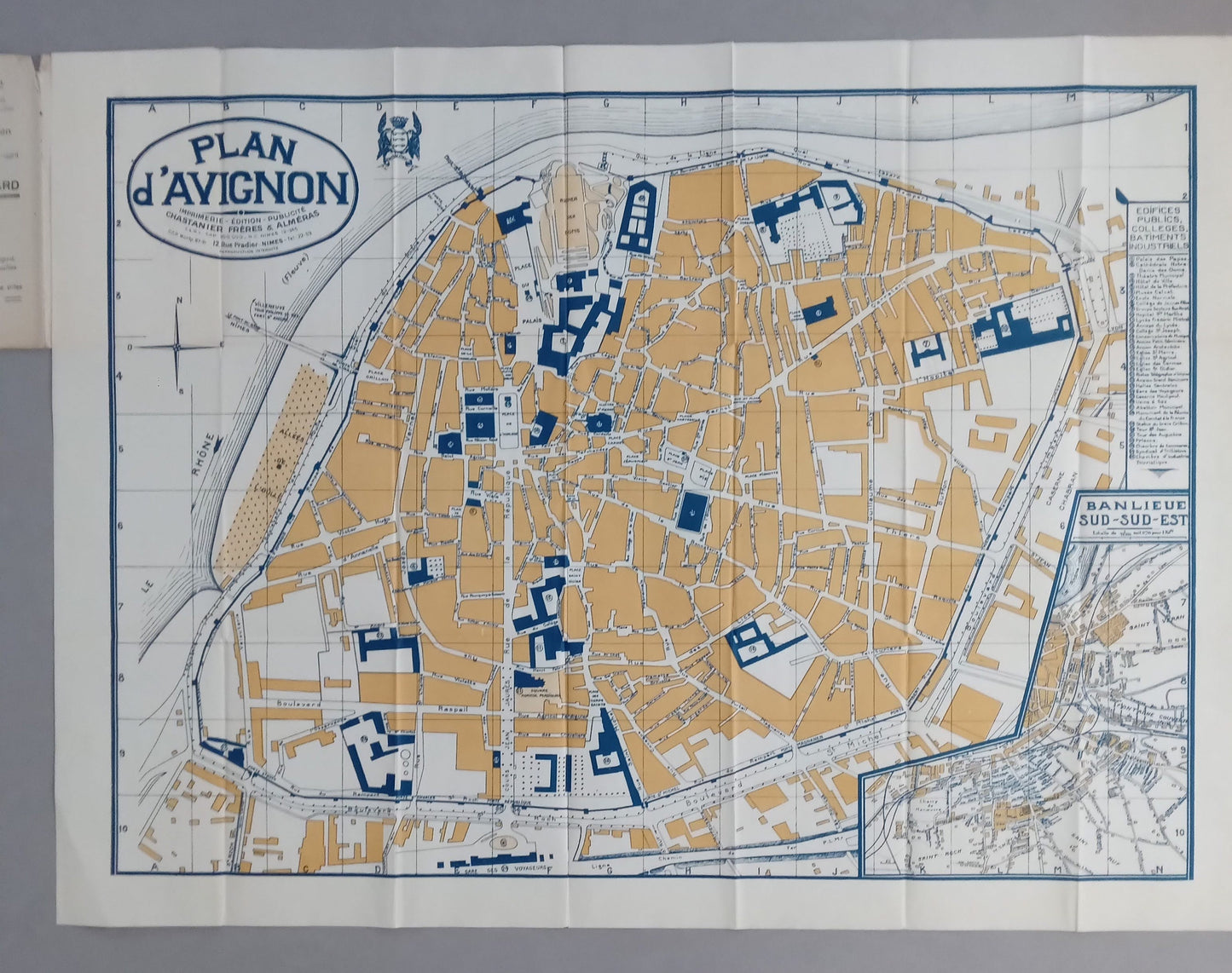
This map of the city of Avignon, dating from the 1920s, accurately depicts the organization of the historic center within the ramparts. Printed in two colors (ochre for buildings and dark blue for public and religious buildings), the map highlights the main monuments such as the Palais des Papes, the Petit Palais, Notre-Dame-des-Doms Cathedral, and the ramparts along the Rhône. The streets are finely drawn, accompanied by an insert dedicated to the south-southeast suburbs. The typography and presentation are characteristic of urban maps from the early 20th century, for practical or tourist use. Dimensions: 76 x 56 cm.
Condition :
Very good condition. Please note, my maps are old and not always in perfect condition!

-

Secure payment
-

Careful shipping
-

No reproduction
-

Satisfied or refunded


-

“Hello, thank you for sending this, the cards are superb!”
Jean-Philippe
-
"They are very beautiful, just need to frame them! Thank you"
Baptiste
-
"Fast shipping and very good tracking."
Alice
-
"My husband loved the maps I gave him for Christmas!"
Solène
