


Illustrated map of Budapest – 1960
Illustrated map of Budapest – 1960
Couldn't load pickup availability
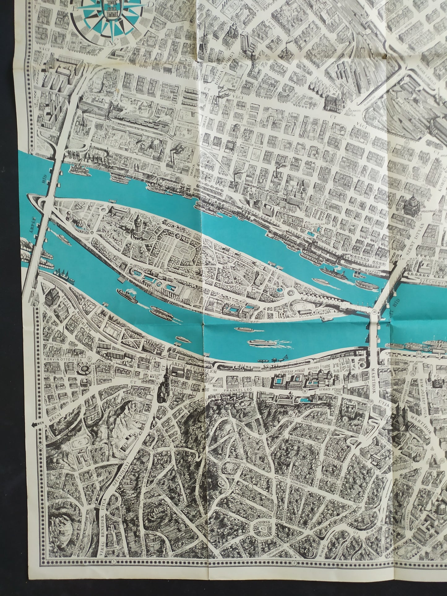
Created by István Mácsai in 1960, this perspective map of Budapest offers a detailed, hand-drawn representation of the city, crossed by the bright blue Danube. The contrast between the steep, densely illustrated districts of Buda to the south and the more regular, grid-like districts of Pest to the north is particularly marked. Monuments, bridges, avenues, and iconic buildings are precisely drawn. The compass rose and ornate cartouche in the upper left complete this large-scale artistic map, both utilitarian and decorative. Dimensions: 117 x 82 cm.
Condition :
Good condition. Please note, my maps are old and not always in perfect condition!
List of main places represented:
Castle District, New Buda, Old Buda, Elisabeth District, Theresa District, Joseph District, Ferenc District, Zugló, Budafok-Tétény


-

Secure payment
-

Careful shipping
-

No reproduction
-

Satisfied or refunded


-

“Hello, thank you for sending this, the cards are superb!”
Jean-Philippe
-
"They are very beautiful, just need to frame them! Thank you"
Baptiste
-
"Fast shipping and very good tracking."
Alice
-
"My husband loved the maps I gave him for Christmas!"
Solène
