


Plan of Brussels for the Universal Exhibition by De Roeck - 1958
Plan of Brussels for the Universal Exhibition by De Roeck - 1958
Couldn't load pickup availability
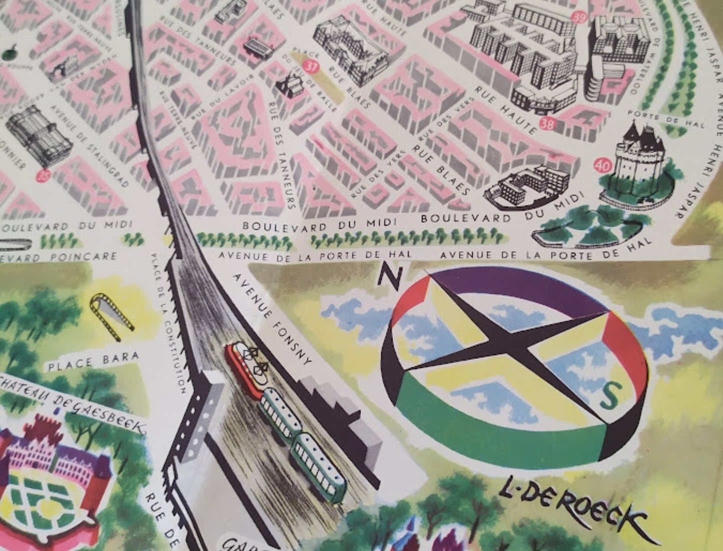
This illustrated tourist map of Brussels was created by the artist Lucien De Roeck (signed lower right) for the 1958 Brussels World's Fair, as indicated by the inscription at the bottom of the poster. This pictorial map presents an overview of the Belgian capital with a pink-tinted street layout and numerous monuments drawn in perspective. It includes detailed illustrations of iconic locations such as the Grand-Place, the Palace of Justice, and the Heysel site with the Atomium visible in the upper left corner. In the lower left corner, a cartouche titled "MAP OF BRUSSELS" contains a key listing 60 points of interest, accompanied by a small inset showing a transport route. De Roeck's modern graphic style is enhanced by a colorful, three-dimensional compass rose and stylized representations of the surrounding parks. The map measures 60 cm by 42 cm.
Condition :
Good condition. Please note, my maps are old and not always in perfect condition!
List of the main locations represented:
Brussels, Grand-Place, Atomium, Palace of Justice, Gare du Midi, Gare du Nord, Royal Palace, Brussels Park, St. Gudula's Cathedral, Stock Exchange, Sablon, Porte de Hal, Erasmus House, Gaesbeek Castle, La Cambre Abbey, Koekelberg Basilica, Cinquantenaire.


-

Secure payment
-

Careful shipping
-

No reproduction
-

Satisfied or refunded


-

“Hello, thank you for sending this, the cards are superb!”
Jean-Philippe
-
"They are very beautiful, just need to frame them! Thank you"
Baptiste
-
"Fast shipping and very good tracking."
Alice
-
"My husband loved the maps I gave him for Christmas!"
Solène
