


Map of London illustrated by Geographia - 1942
Map of London illustrated by Geographia - 1942
Couldn't load pickup availability
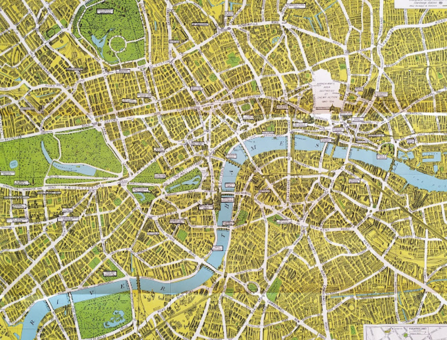
This map of London from the Second World War era is a fascinating pictorial work published by Geographia Map Co. Ltd. The document covers central London, stretching from Hammersmith Bridge in the west to the London Docks in the east. A key historical feature of this map is the area highlighted in white near Guildhall, indicating the "approximate area destroyed by enemy action 1940-1941." Unlike typical city maps of this period, this poster adopts an illustrated style with many landmarks depicted in three dimensions, such as St. Paul's Cathedral, Tower Bridge, and the Houses of Parliament. Parks and gardens like Hyde Park and Battersea Park are shown in vibrant green, while the River Thames is enlivened with small illustrations of ships. Two detailed insets in the lower corners show "Theaterland" (theatre district) and the cinemas of the time, respectively. Underground stations are also included, and an index of points of interest is located in the upper left corner. This document was printed in Holland by L. Van Leer and Co. The map measures 48 cm by 74 cm.
Condition :
Good condition. Please note, my maps are old and not always in perfect condition!
List of the main locations represented:
Hyde Park, Kensington Gardens, Battersea Park, Regent's Park, River Thames, St. Paul's Cathedral, Guildhall, Bank of England, Tower of London, Buckingham Palace, Mansion House, Cannon Street, Southwark Bridge, London Bridge, Waterloo Bridge, Liverpool Street Station, Marylebone, Chelsea, Lambeth, Whitechapel, Holborn, Fleet Street.


-

Secure payment
-

Careful shipping
-

No reproduction
-

Satisfied or refunded


-

“Hello, thank you for sending this, the cards are superb!”
Jean-Philippe
-
"They are very beautiful, just need to frame them! Thank you"
Baptiste
-
"Fast shipping and very good tracking."
Alice
-
"My husband loved the maps I gave him for Christmas!"
Solène
