


Map of Paris by Lucien Boucher - 1949
Map of Paris by Lucien Boucher - 1949
Couldn't load pickup availability
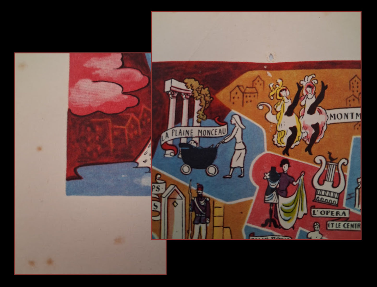
This pictorial map of Paris, created by Lucien Boucher, is a whimsical and lively interpretation of the capital's most famous neighborhoods. The map does not follow a strict geography but focuses on the essence of each place through illustrations full of humor and detail. It features iconic scenes from life: the can-can dancers of the Moulin Rouge in Montmartre, a tourist admiring the Venus de Milo at the Louvre, an officer on horseback at the Champ-de-Mars, and a boat on the Canal Saint-Martin. The Seine winds through the city, which is encircled by a richly illustrated decorative border. Lucien Boucher, a renowned illustrator and poster artist, is famous for his allegorical maps, which, like this one, combine artistic precision and imagination. Small in size, the map measures 16.5 cm by 24 cm.
Condition:
Good condition, presence of holes (old staple) in the margin at the top and bottom center. Please note, my maps are old and are not always in perfect condition!
List of main places represented:
Paris, Saint-Germain-des-Prés, Champs-Elysées, Belleville, Ménilmontant, The Marais, The Latin Quarter, Montmartre, The Louvre, The Canal Saint-Martin, Champs-de-Mars-Invalides, La Villette, The Glacière, Bercy, Les Halles, The Opera


-

Secure payment
-

Careful shipping
-

No reproduction
-

Satisfied or refunded


-

“Hello, thank you for sending this, the cards are superb!”
Jean-Philippe
-
"They are very beautiful, just need to frame them! Thank you"
Baptiste
-
"Fast shipping and very good tracking."
Alice
-
"My husband loved the maps I gave him for Christmas!"
Solène
