


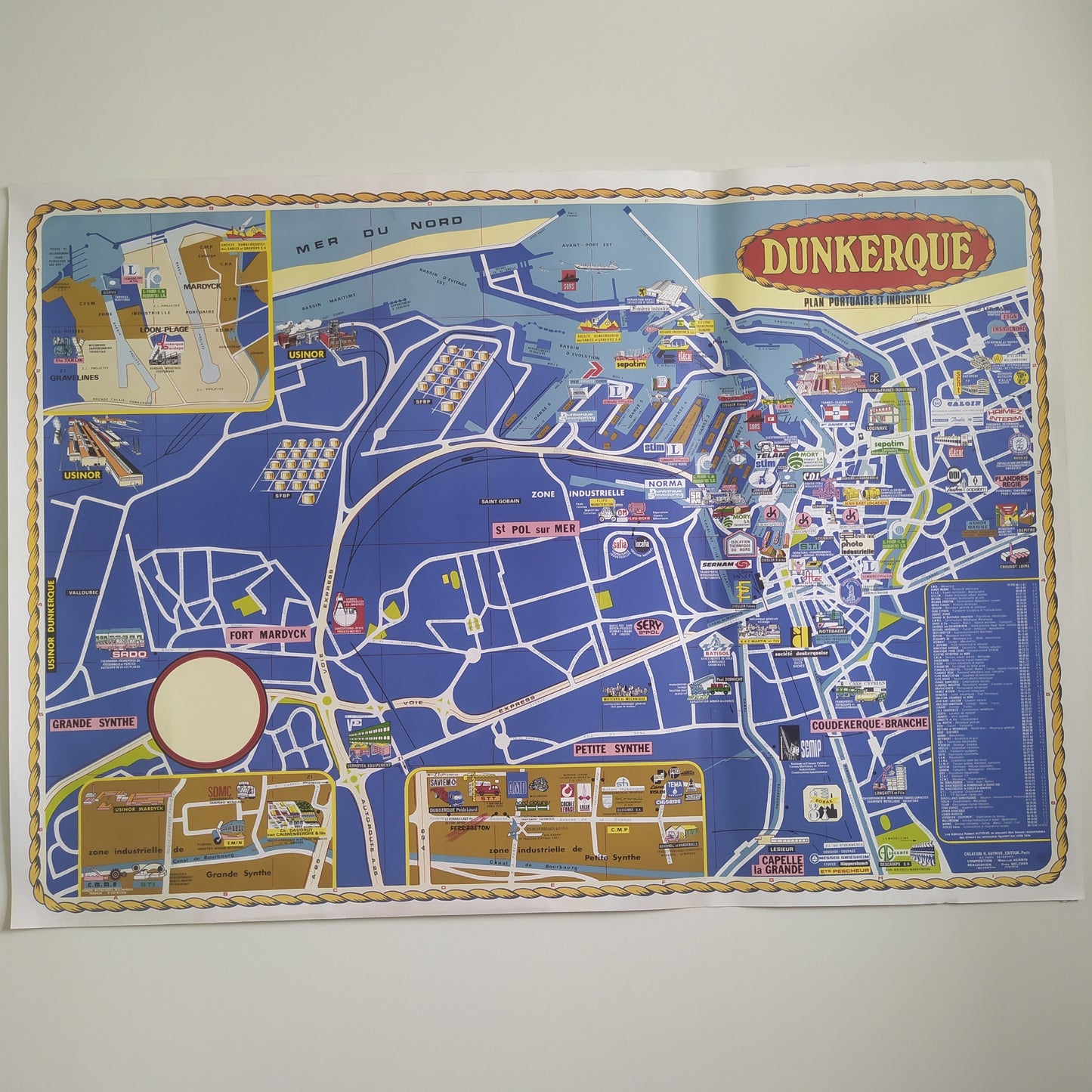
Illustrated map of Dunkirk by Jorj Morin - 1960s
Illustrated map of Dunkirk by Jorj Morin - 1960s
Couldn't load pickup availability
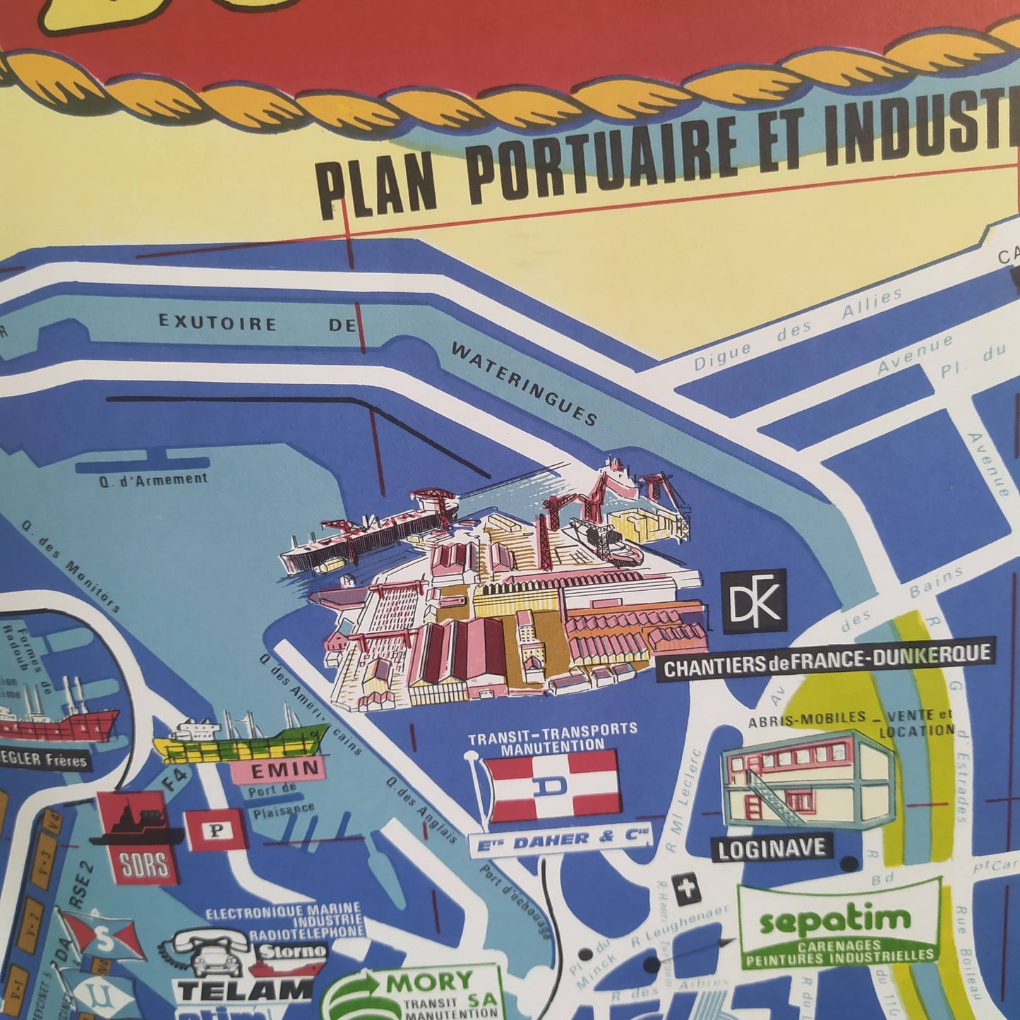
This illustrated map of Dunkirk from the 1960s, created by Jorj Morin, offers a colorful and detailed representation of the city. The map highlights key landmarks, port infrastructure, and residential areas through vivid illustrations. Streets and industrial areas are clearly marked, providing a comprehensive view of Dunkirk's urban layout at the time. The map also includes illustrations of iconic buildings and scenes from daily life, offering a charming glimpse into the city. Dimensions: 100 x 70 cm.
Condition :
Very good condition. Please note, my maps are old and are not always in perfect condition! Sent in a tube.
List of main places represented:
Dunkirk, Grande-Synthe, Petite-Synthe, Malo-les-Bains, Rosendaël, Mardyck, Saint-Pol-sur-Mer, Cappelle-la-Grande, Coudekerque-Branche, France, North (department), Hauts-de-France (region), North Sea, Europe


-

Secure payment
-

Careful shipping
-

No reproduction
-

Satisfied or refunded


-

“Hello, thank you for sending this, the cards are superb!”
Jean-Philippe
-
"They are very beautiful, just need to frame them! Thank you"
Baptiste
-
"Fast shipping and very good tracking."
Alice
-
"My husband loved the maps I gave him for Christmas!"
Solène
