


Illustrated tourist map of Moscow - German version ca. 1960
Illustrated tourist map of Moscow - German version ca. 1960
Couldn't load pickup availability
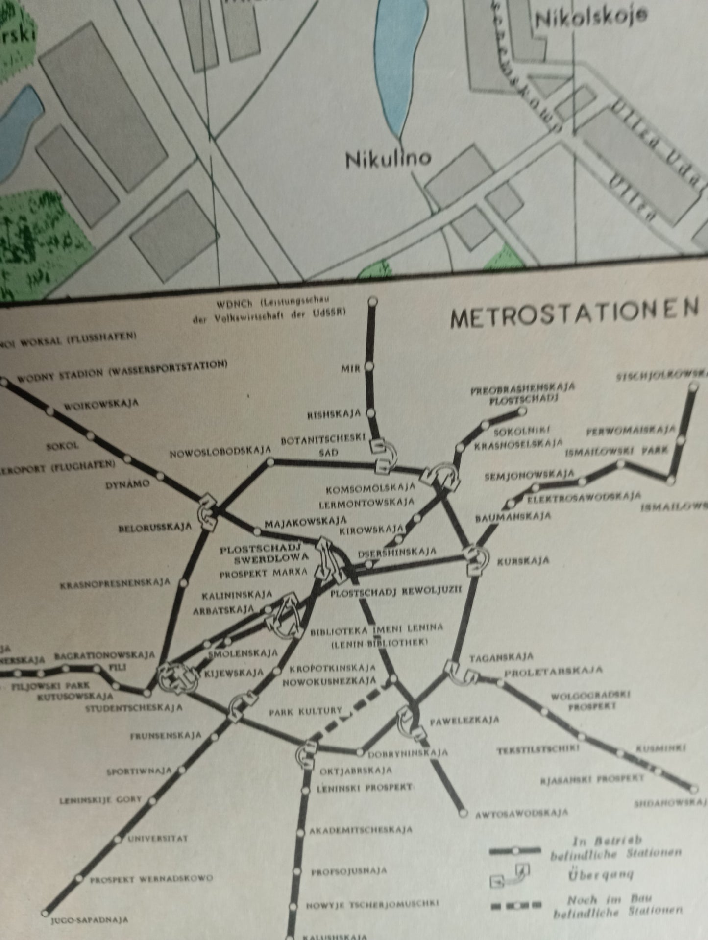
This tourist map of Moscow, written in German, is an illustrative map that showcases the city with a detailed graphic style, and is likely intended for Soviet-era visitors. Major landmarks, such as the Kremlin and Lomonosov University, are depicted in drawings. The map uses soft colors and illustrations to highlight landmarks, parks, and rivers. A table lists the landmarks with numbers, making navigation easier. Main streets and the various metro stations (indicated by an 'M') are clearly legible. An insert is dedicated to the Moscow Metro stations. The map offers a unique visual glimpse of the city in the 1960s. The map measures 77 cm by 70 cm.
Condition :
Good condition Please note, my maps are old and are not always in perfect condition!
List of main places represented:
Moscow, Kremlin, Red Square, Moskva River, Lomonosov University, Lenin Stadium, Sparrow Hills, Komsomolskaya Square, Gorky Garden, Tverskaya Street, Tsvetnoy Boulevard.


-

Secure payment
-

Careful shipping
-

No reproduction
-

Satisfied or refunded


-

“Hello, thank you for sending this, the cards are superb!”
Jean-Philippe
-
"They are very beautiful, just need to frame them! Thank you"
Baptiste
-
"Fast shipping and very good tracking."
Alice
-
"My husband loved the maps I gave him for Christmas!"
Solène
