


Monumental and pictorial plan of Lille - ca. 1930
Monumental and pictorial plan of Lille - ca. 1930
Couldn't load pickup availability
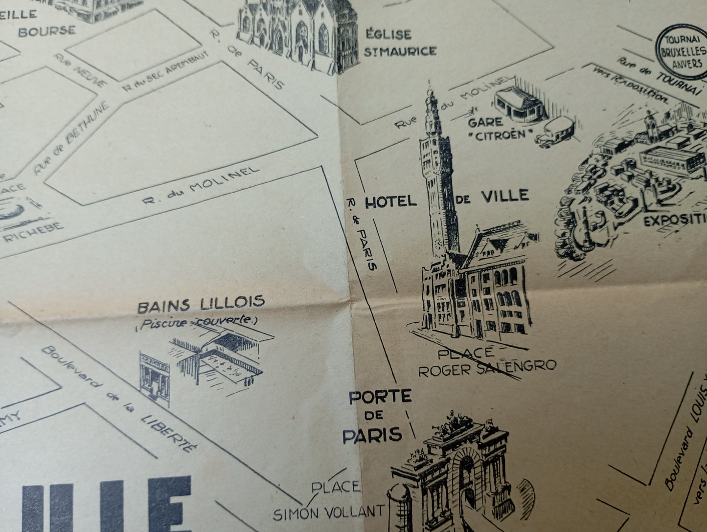
This map of Lille, illustrated and published by the Tourist Office "Les Amis de Lille," is an artistic representation of the city center and its iconic monuments. The map, produced in black and white, highlights the main buildings and places of interest with detailed illustrations. Rather than showing every street, it focuses on a pictorial view of important sites such as the Grand'Place, the Grand Théâtre, the Vieille Bourse, the Palais des Beaux-Arts, and the Hôtel de Ville. This map was designed to guide the visitor while giving them an artistic perspective of the places, creating a visual souvenir of the city. The map measures 31 cm by 39 cm.
Condition :
Good condition Please note, my maps are old and are not always in perfect condition!
List of main places represented:
Grand Place, Old Stock Exchange, New Stock Exchange, Grand Theatre, City Hall, Paris Gate, Palace of Fine Arts, Rihour Palace, Basilica of Notre-Dame de la Treille, Citadel, Ghent Gate, Roubaix Gate.


-

Secure payment
-

Careful shipping
-

No reproduction
-

Satisfied or refunded


-

“Hello, thank you for sending this, the cards are superb!”
Jean-Philippe
-
"They are very beautiful, just need to frame them! Thank you"
Baptiste
-
"Fast shipping and very good tracking."
Alice
-
"My husband loved the maps I gave him for Christmas!"
Solène
