


Vintage monumental map of Genoa - ca. 1950
Vintage monumental map of Genoa - ca. 1950
Couldn't load pickup availability
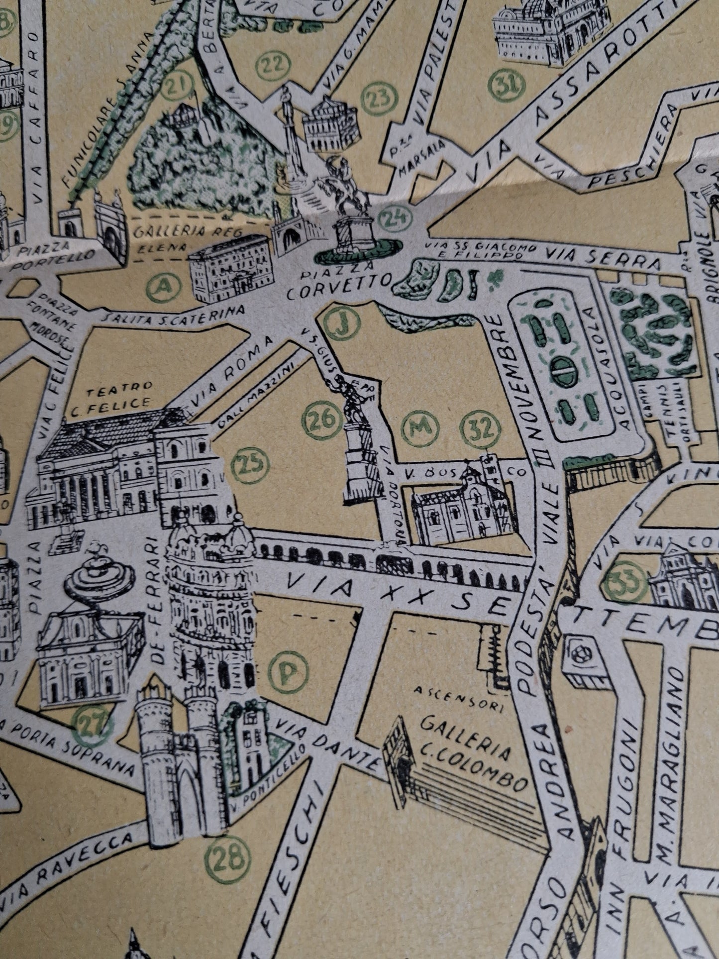
This illustrated monumental map presents the city of Genoa (Genova) with particular emphasis on its most important buildings and monuments. The map is drawn in a pictorial style, where key buildings are shown in perspective, giving a sense of relief and facilitating site identification. The port area (Porto) of Genoa is highlighted in a distinctive blue-green color, contrasting with the pale yellow of the urban areas. Numerous numbered and lettered legends link to a detailed list of palaces, churches, museums, theaters, and other points of interest, located at the bottom of the map (including the Palazzo Ducale, the Cattedrale S. Lorenzo, the Teatro Paganini, etc.). The topography of the city, with its winding streets and development around the harbor, is clearly illustrated. The map measures approximately 50 cm by 35 cm.
Condition :
Good condition Please note, my maps are old and are not always in perfect condition!
List of main places represented:
Genova (Genoa), Porto di Genova, Via Balbi, Piazza de Ferrari, Piazza Corvetto, Via XX Settembre, Via Venti Settembre, Viale III Novembre, Via Cairoli, Molo Vecchio, Molo Nuovo, Via S. Lorenzo, Palazzo del Governo, Casa del Fascio, Palazzo Tursi, R. Questura, Palazzo Ducale, R. Dogana, R. Capitaneria, Cattedrale S. Lorenzo, Teatro Paganini.


-

Secure payment
-

Careful shipping
-

No reproduction
-

Satisfied or refunded


-

“Hello, thank you for sending this, the cards are superb!”
Jean-Philippe
-
"They are very beautiful, just need to frame them! Thank you"
Baptiste
-
"Fast shipping and very good tracking."
Alice
-
"My husband loved the maps I gave him for Christmas!"
Solène
