


Sixth Air Force Illustrated Map of Panama - ca. 1940
Sixth Air Force Illustrated Map of Panama - ca. 1940
Couldn't load pickup availability
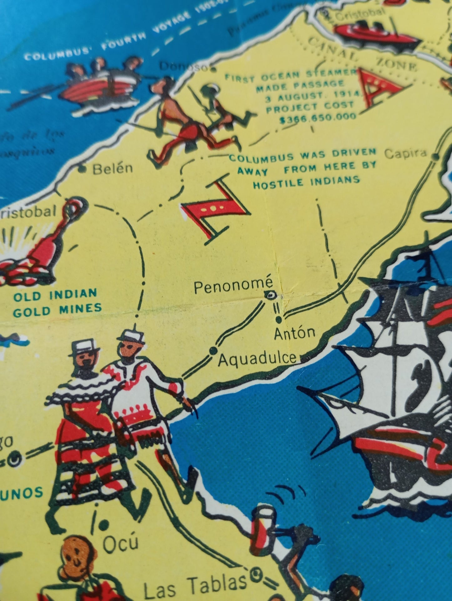
This tourist map of Panama is a humorous illustrated map created by the Sixth Air Force Headquarters during World War II. The map is a souvenir for military personnel stationed in the region, presenting important roads and locations in a playful way. It features caricatured drawings of soldiers and historical figures populating the map, ships sailing the Pacific Ocean and the Caribbean Sea, and scenes of local life. The focus is on the history of the region and the Panama Canal, with specific annotations for places of interest. The map has a vintage feel and a fun style that makes it unique. The map measures 48 cm by 31 cm.
Condition :
Good condition Please note, my maps are old and are not always in perfect condition!
List of main places represented:
Panama, Panama Canal, Pacific Ocean, Caribbean Sea, Colón, Panama City, Gulf of Panama, Azuero Peninsula, Pearl Islands, Costa Rica, Colombia.


-

Secure payment
-

Careful shipping
-

No reproduction
-

Satisfied or refunded


-

“Hello, thank you for sending this, the cards are superb!”
Jean-Philippe
-
"They are very beautiful, just need to frame them! Thank you"
Baptiste
-
"Fast shipping and very good tracking."
Alice
-
"My husband loved the maps I gave him for Christmas!"
Solène
