


Pictorial plan of Rome by A. Marendino - 1950
Pictorial plan of Rome by A. Marendino - 1950
Couldn't load pickup availability
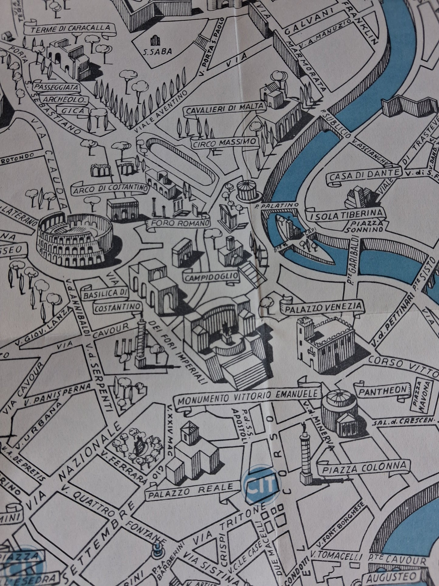
This detailed illustrated tourist map depicts the city of Rome. Its pictorial style is characteristic of tourist maps produced to guide visitors through the Italian capital's major monuments and places of interest. The map highlights famous historical and archaeological sites such as the Colosseum, the Roman Forum, the Pantheon, Vatican City, Castel Sant'Angelo, and the Monument to Vittorio Emanuele II. The River Tiber (Tevere) is depicted in blue, winding through the city and serving as a central landmark. The main streets are clearly labeled, and many buildings are drawn in perspective, giving the map depth and a special charm. The work is identified as the reserved artistic property of ditta A. Marendino, as indicated in the lower corner, emphasizing its origin and copyright. The map measures approximately 51 cm by 48 cm.
Condition :
Very good condition Please note, my maps are old and are not always in perfect condition!
List of main places represented:
Rome, Tiber (Tevere), Colosseo (Colosseum), Foro Romano (Roman Forum), Campidoglio, Monumento Vittorio Emanuele (Vittoriano), Pantheon, Piazza Colonna, Piazza del Popolo, Castel S. Angelo, Città del Vaticano, Basilica di S. Pietro, Circo Massimo, Terme di Caracalla, Arco di Costantino, Piazza di Spagna, Fontana di Trevi, Villa Borghese, Villa Savoi, Piazza Venezia, Isola Tiberina, Gianicolo.


-

Secure payment
-

Careful shipping
-

No reproduction
-

Satisfied or refunded


-

“Hello, thank you for sending this, the cards are superb!”
Jean-Philippe
-
"They are very beautiful, just need to frame them! Thank you"
Baptiste
-
"Fast shipping and very good tracking."
Alice
-
"My husband loved the maps I gave him for Christmas!"
Solène
