


Pictorial and tourist map of Copenhagen - ca. 1960
Pictorial and tourist map of Copenhagen - ca. 1960
Couldn't load pickup availability
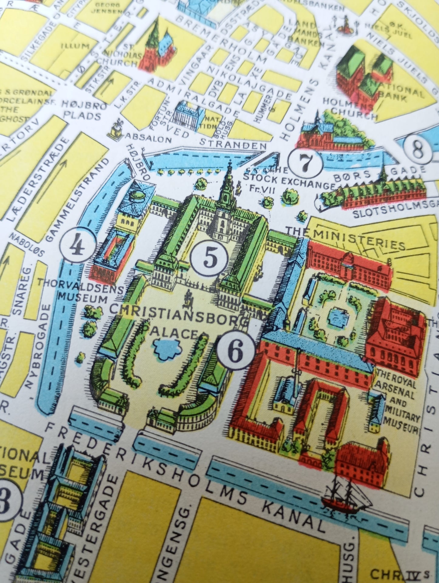
This illustrated tourist map of Copenhagen's Old Town was published by the Tourist Association of Copenhagen. The map is richly illustrated, highlighting the Danish capital's main monuments, parks, and canals with perspective drawings. Landmarks such as Christiansborg Palace, Tivoli Gardens, Rosenborg Castle, and the Old Stock Exchange (Børsen) are numbered and easily identifiable. The map, with its streets in bright yellow, parks in green, and canals in blue, is designed as a practical and attractive guide for visitors exploring the city's historic heart. The map measures 33.5 cm by 49 cm.
Condition :
Very good condition. Please note, my maps are old and are not always in perfect condition!
List of main places represented:
Copenhagen, Tivoli, Christiansborg Palace, Rosenborg Castle, Børsen (Stock Exchange), Botanical Garden, National Gallery, Vesterbro, Østerbro, Christianshavn, Denmark.


-

Secure payment
-

Careful shipping
-

No reproduction
-

Satisfied or refunded


-

“Hello, thank you for sending this, the cards are superb!”
Jean-Philippe
-
"They are very beautiful, just need to frame them! Thank you"
Baptiste
-
"Fast shipping and very good tracking."
Alice
-
"My husband loved the maps I gave him for Christmas!"
Solène
