


Retro map of Lausanne by the Union of Swiss Banks - 1926
Retro map of Lausanne by the Union of Swiss Banks - 1926
Couldn't load pickup availability
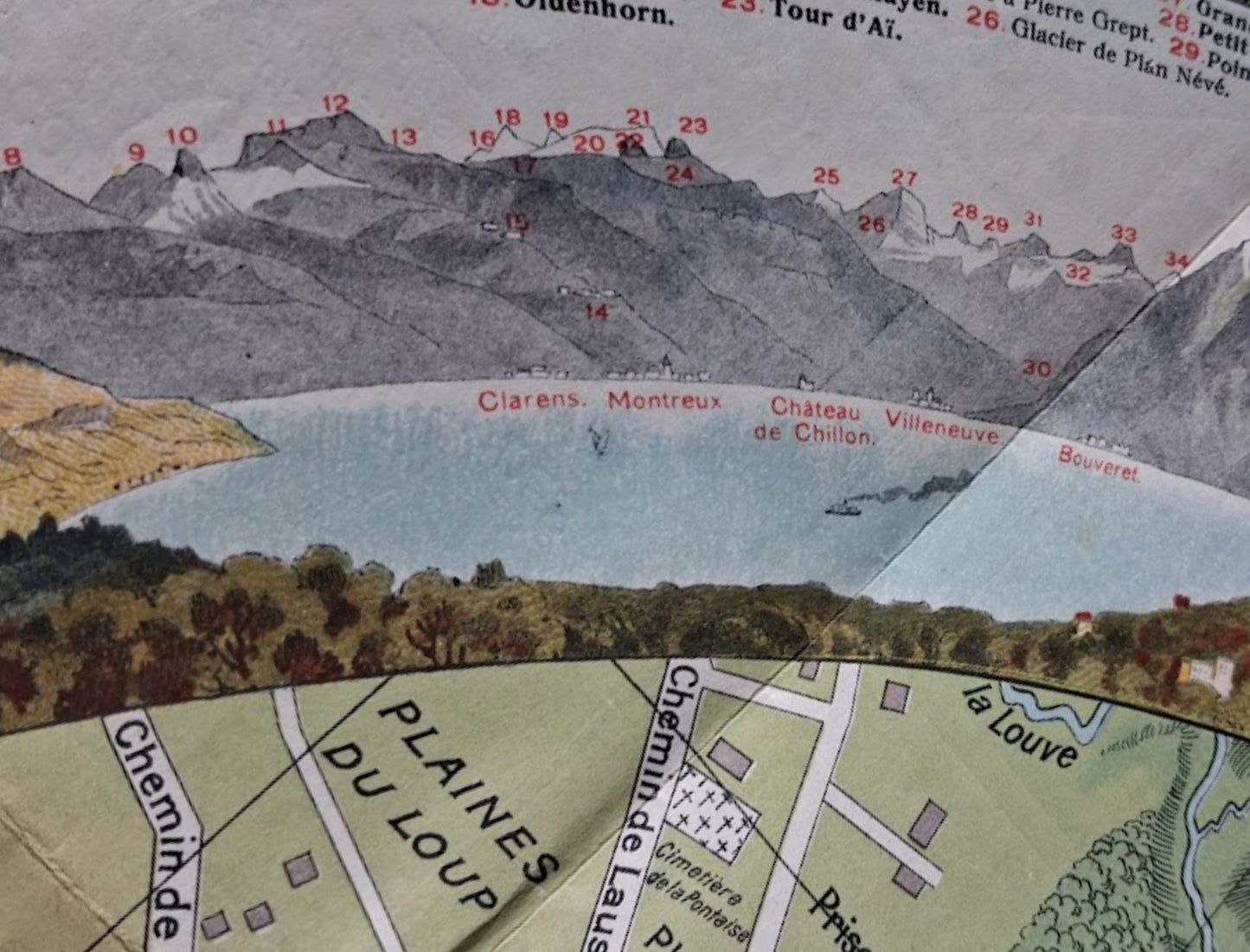
An antique, illustrated tourist map of the city of Lausanne, Switzerland, entitled "PANORAMA DU SIGNAL." This color lithograph, created by the Union Bank of Switzerland (UBS) around 1926, is a typical example of early 20th-century illustrated maps, combining geographical accuracy with artistic embellishments. The map focuses on the urban details of Lausanne, including railways, roads, buildings (some highlighted by ochre illustrations, such as the Cité devant and the Place de la Riponne), parks, and the shores of Lake Geneva. A notable feature is the upper section, which depicts a panoramic view of the Alps on the horizon, indexed by the names of the peaks, adding both a scenic and informative dimension. The map also included an index of place names in an accompanying booklet, making it highly practical. Vignettes of statues frame the panorama in the upper corners. This pocket map was designed to facilitate daily travel within the city, reflecting the importance of infrastructure and connectivity during the interwar period. The map measures 54 cm by 47 cm (on a 57 x 49 cm unfolded sheet).
Condition :
Good condition. Please note, my maps are old and not always in perfect condition!
List of the main locations represented:
Lausanne, Lake Geneva, Le Signal, Place de la Riponne, Place du Tunnel, Cité devant, Du Signal, Clarens, Montreux, Château de Chillon, Villeneuve, Bouveret, Mont Blanc (indexed on the panorama).


-

Secure payment
-

Careful shipping
-

No reproduction
-

Satisfied or refunded


-

“Hello, thank you for sending this, the cards are superb!”
Jean-Philippe
-
"They are very beautiful, just need to frame them! Thank you"
Baptiste
-
"Fast shipping and very good tracking."
Alice
-
"My husband loved the maps I gave him for Christmas!"
Solène
