


Illustrated tourist map of Moscow - ca. 1960
Illustrated tourist map of Moscow - ca. 1960
Couldn't load pickup availability
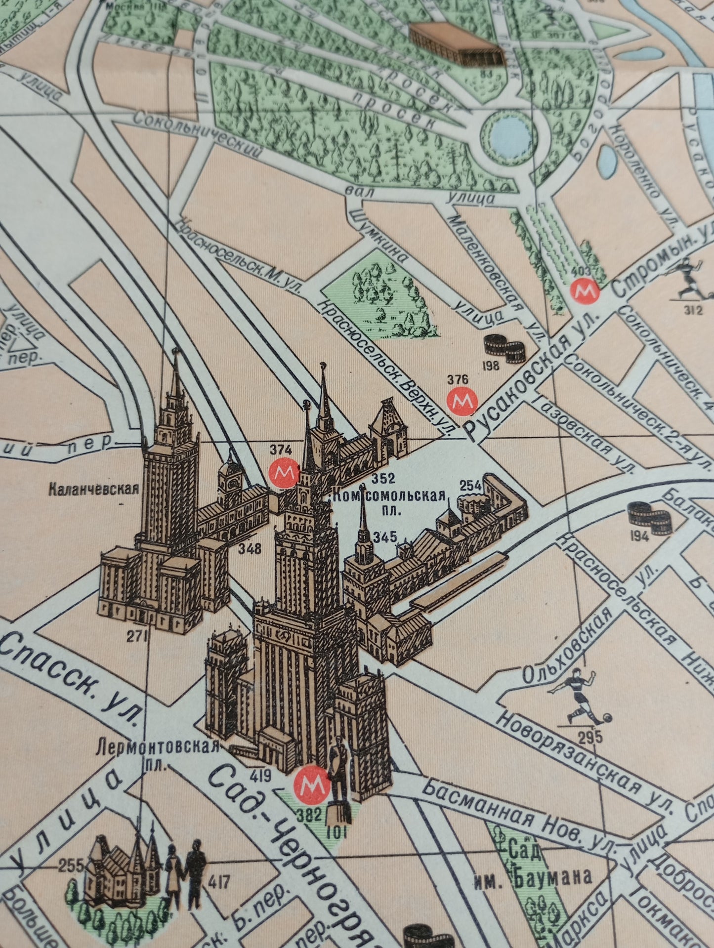
This tourist map of Moscow is an illustrative map that showcases the city with a detailed graphic style, likely intended for Soviet-era visitors. Major landmarks, such as the Kremlin and Lenin Stadium, are depicted in drawings. The map uses soft colors and illustrations to highlight landmarks, parks, and rivers. A table lists landmarks with numbers, making navigation easier. Main streets and the various metro stations (indicated by an 'M') are clearly legible. The map offers a unique visual glimpse of the city in the 1960s. The map measures 77 cm by 70 cm.
Condition :
Good condition Please note, my maps are old and are not always in perfect condition!
List of main places represented:
Moscow, Kremlin, Red Square, Moskva River, Alexander Garden, Lenin Stadium, Sparrow Hills, Komsomolskaya Square, Tverskaya Street, Tsvetnoy Boulevard, Gorky Garden.


-

Secure payment
-

Careful shipping
-

No reproduction
-

Satisfied or refunded


-

“Hello, thank you for sending this, the cards are superb!”
Jean-Philippe
-
"They are very beautiful, just need to frame them! Thank you"
Baptiste
-
"Fast shipping and very good tracking."
Alice
-
"My husband loved the maps I gave him for Christmas!"
Solène
