


Vintage tourist map of Antwerp - 1954
Vintage tourist map of Antwerp - 1954
Couldn't load pickup availability
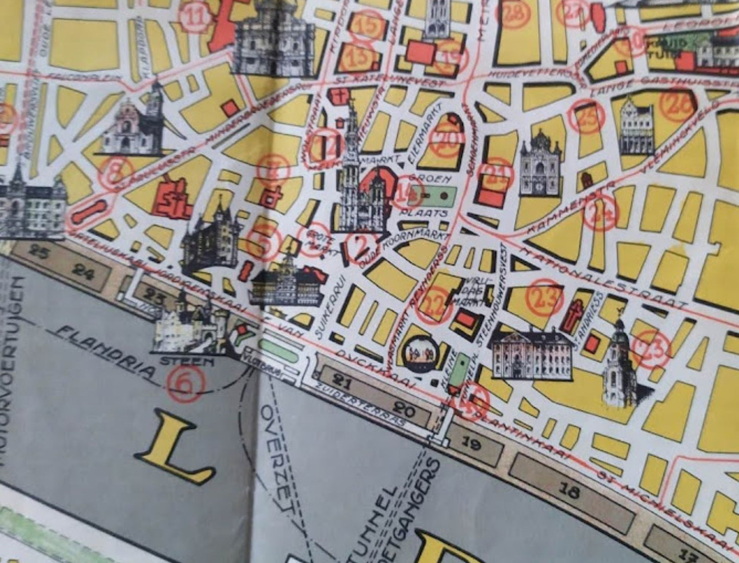
This map of Antwerp, entitled "Antwerpen Plattegrond der Stad" (Antwerp City Map), is an illustrated tourist map published by the "Dienst voor Propaganda en Toerisme" (Service for Tourism Promotion). The map presents a detailed view of the city center along the Scheldt River, as well as specific insets highlighting the city's parks, such as Rivierenhof Park, Te Boelaerpark, and Nachtegalenpark. The map is enhanced with numerous illustrations of iconic landmarks drawn in perspective, allowing for quick identification of historical sites. An illustrated key in the lower right corner lists the main buildings, including the Cathedral and the City Hall. The graphic style is characteristic of the 1950s, with a pastel color palette and precise lines. The map measures 60 cm by 47 cm.
Condition :
Good condition. Please note, my maps are old and not always in perfect condition!
List of the main locations represented:
Antwerp (Antwerpen), Scheldt (Schelde), Park Rivierenhof, Sterckshof, Te Boelaerpark, Boekenbergpark, Nachtegalenpark, Grote Markt, Cathedral (Onze-Lieve-Vrouwekathedraal), Het Steen, Central Station (Station Antwerpen-Oost), Kattendijkdok, Willemdok, Zuiderterras, Linkeroever.


-

Secure payment
-

Careful shipping
-

No reproduction
-

Satisfied or refunded


-

“Hello, thank you for sending this, the cards are superb!”
Jean-Philippe
-
"They are very beautiful, just need to frame them! Thank you"
Baptiste
-
"Fast shipping and very good tracking."
Alice
-
"My husband loved the maps I gave him for Christmas!"
Solène
