


Illustrated map of Treviso by S. Pancian - ca. 1950
Illustrated map of Treviso by S. Pancian - ca. 1950
Couldn't load pickup availability
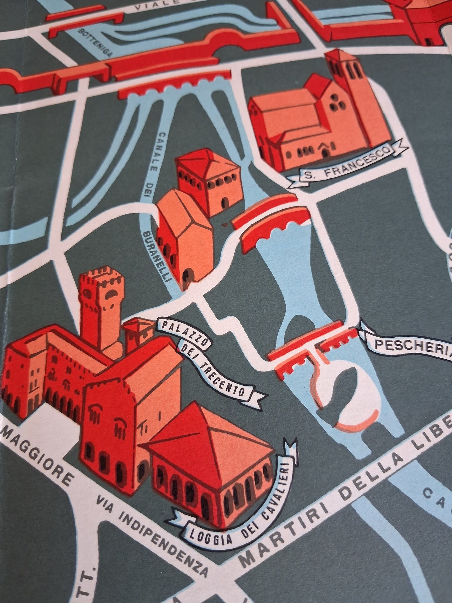
This illustrated map of the city of Treviso is distinguished by its graphic style and contrasting colors (red, light blue, and dark gray-green). The map highlights the historic center and its fortifications, delimited by moats and the Sile and Botteniga rivers (light blue lines). Important monuments (such as the Duomo, S. Francesco, Palazzo dei Trecento, Loggia dei Cavalieri, etc.) are pictorially represented in red. The main road axes (in white and red) are named (Viale Cadorna, Via Indipendenza, Via XX Sett., etc.), as well as the rivers and canals (Fiume Sile, Sile, Botteniga, Canale dei Buranelli). The signature "S. Pancian" is visible in the lower right corner, indicating the author. The map dimensions are 47 cm by 34 cm.
Condition :
Good condition Please note, my maps are old and are not always in perfect condition!


-

Secure payment
-

Careful shipping
-

No reproduction
-

Satisfied or refunded


-

“Hello, thank you for sending this, the cards are superb!”
Jean-Philippe
-
"They are very beautiful, just need to frame them! Thank you"
Baptiste
-
"Fast shipping and very good tracking."
Alice
-
"My husband loved the maps I gave him for Christmas!"
Solène
