


Retro illustrated map of Béziers by Jorj Morin - ca. 1960
Retro illustrated map of Béziers by Jorj Morin - ca. 1960
Couldn't load pickup availability
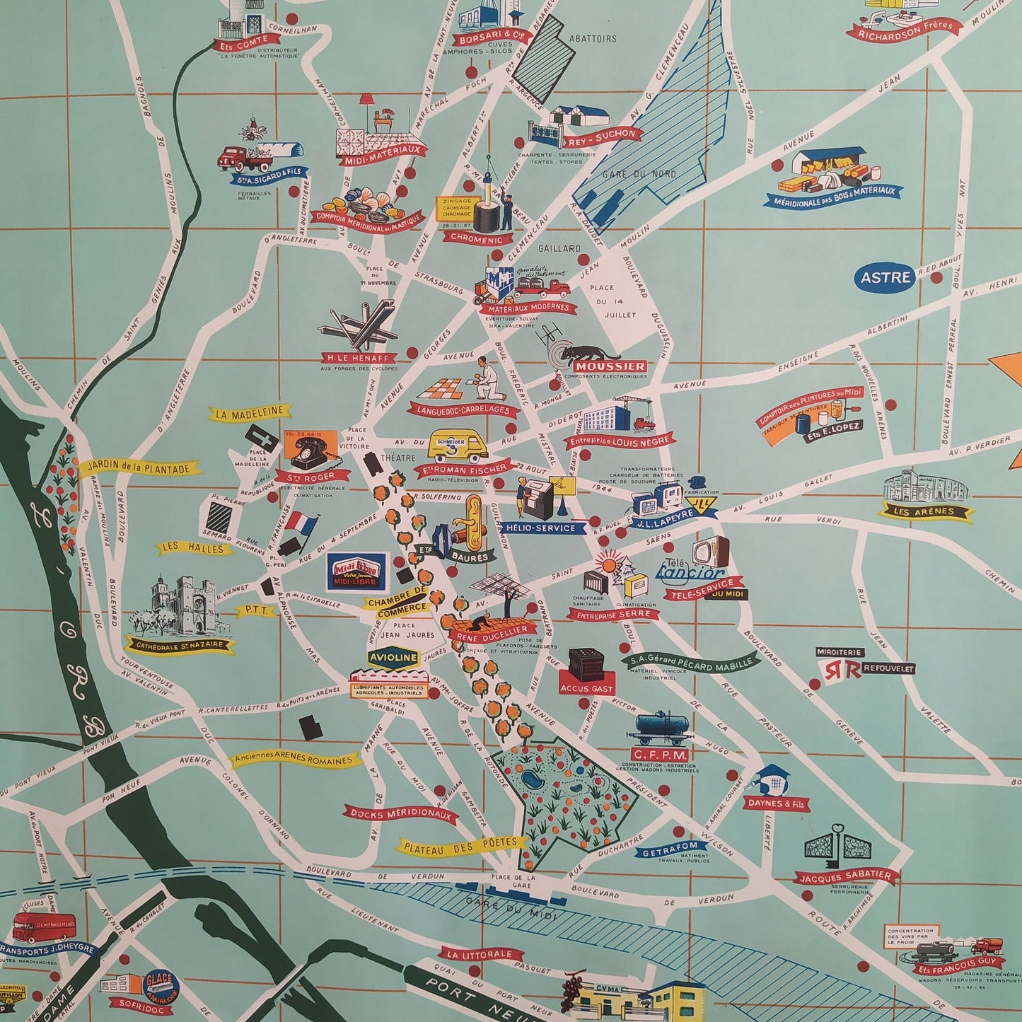
This illustrated map of the city of Béziers was created by French artist and graphic designer Jorj Morin around the 1960s. The work is a piece of advertising cartography that highlights the city's industrial vocation, as indicated by the central banner "BÉZIERS LES INDUSTRIES," surmounted by the city's coat of arms. Morin's style is immediately recognizable by its painterly aesthetic and bright, contrasting colors. The city is presented against a blue-green grid background, with the streets in white. The River Orb and the Canal du Midi (with the Fonséranes lock clearly visible) cross the map, demarcating areas. Numerous drawn vignettes, colored in red, yellow, blue, and black, illustrate the city's main businesses, industries, and shops, offering a glimpse into the economic landscape of the time. These detailed illustrations transform this geographical document into a true vintage and tourist poster. The map measures 90 cm by 58 cm.
Condition :
Very good condition. Please note, my maps are old and not always in perfect condition! Sent in a tube.
List of main places represented:
Béziers, Orb, Canal du Midi, Fonséranes Lock, Rivescape, Pont-Neuf, Plateau des Poètes, La Madeleine, Allées de la Liberté, Theater, Arenas, Technical High School, Industrial Zone, Avenue Jean Moulin.


-

Secure payment
-

Careful shipping
-

No reproduction
-

Satisfied or refunded


-

“Hello, thank you for sending this, the cards are superb!”
Jean-Philippe
-
"They are very beautiful, just need to frame them! Thank you"
Baptiste
-
"Fast shipping and very good tracking."
Alice
-
"My husband loved the maps I gave him for Christmas!"
Solène
