


Vintage illustrated map of Glasgow - ca. 1960
Vintage illustrated map of Glasgow - ca. 1960
Couldn't load pickup availability
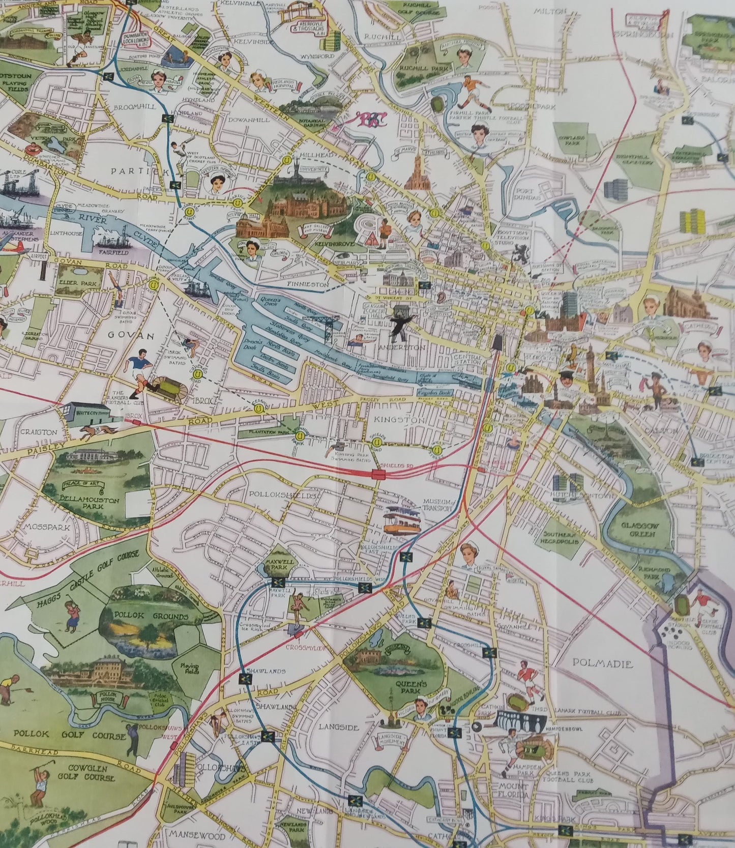
This pictorial map of the city of Glasgow was issued by the Glasgow Corporation Information Office in the 1960s. It is a richly illustrated map, showing the city's main buildings, monuments, parks, and districts with charming drawings. It shows railway stations, bus and subway routes, as well as iconic landmarks such as the Cathedral, the University, Scottish Television Studios, and numerous parks. The River Clyde runs through the map, bordered by quays and harbor areas. This plan offers a colorful and detailed account of life in Glasgow at this time. The map measures 56 cm by 43 cm.
Condition :
Good condition Please note, my maps are old and are not always in perfect condition!
List of main places represented:
Glasgow, River Clyde, Govan, Partick, Anderston, Kelvingrove, Pollokshields, Port Dundas, St. Mungo's Cathedral, University of Glasgow, Central Station, Queen Street Station, George Square, Glasgow Green.


-

Secure payment
-

Careful shipping
-

No reproduction
-

Satisfied or refunded


-

“Hello, thank you for sending this, the cards are superb!”
Jean-Philippe
-
"They are very beautiful, just need to frame them! Thank you"
Baptiste
-
"Fast shipping and very good tracking."
Alice
-
"My husband loved the maps I gave him for Christmas!"
Solène
