


Vintage illustrated map of Jerusalem - ca. 1960
Vintage illustrated map of Jerusalem - ca. 1960
Couldn't load pickup availability
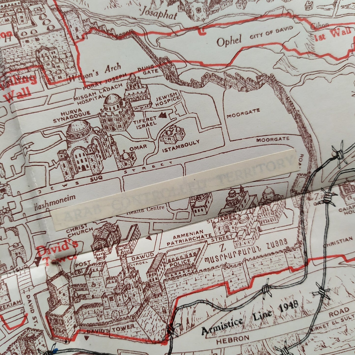
Old-style tourist pictorial map of Jerusalem entitled "JERUSALEM IN PANORAMA," dating from the 1960s. This map, oriented to the east (indicated by a "NORTH" arrow), presents a panoramic and detailed view of the city. It is particularly significant because it highlights the demarcation lines following the 1948 war: the "Armistice Line 1948" is clearly drawn in red, dividing the city. The territory under Arab control is also indicated ("ARAB CONTROLLED TERRITORY"). A key in the upper left corner specifies the different areas: "The Holy City and surroundings, not drawn to scale," "The Old City, walled section," "Jewish section," "Arab section," and the ceasefire lines (blue, red, green). The map is rich in pictorial illustrations of buildings, historical sites, and neighborhoods, offering a unique perspective on the divided city at that time. The grid around the edges allows for easy location. Dimensions: 56 cm by 40 cm
Condition :
Good condition Please note, my maps are old and are not always in perfect condition!
List of main places represented:
Old City, Mount of Olives, Mount Zion, Armistice Line 1948, Arab Controlled Territory, No Man's Land, Jewish Hospice, Tiferet Israel, Arab Quarters, David's Gate, City Wall.


-

Secure payment
-

Careful shipping
-

No reproduction
-

Satisfied or refunded


-

“Hello, thank you for sending this, the cards are superb!”
Jean-Philippe
-
"They are very beautiful, just need to frame them! Thank you"
Baptiste
-
"Fast shipping and very good tracking."
Alice
-
"My husband loved the maps I gave him for Christmas!"
Solène
