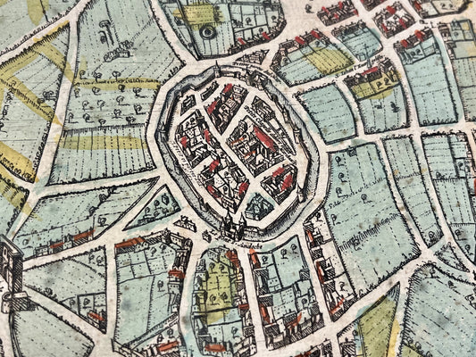
A monumental project: the Civitates Orbis Terrarum
Georg Braun (1541-1622) is primarily known for being the editor and principal coordinator of the Civitates Orbis Terrarum. Published in Cologne from 1572 onwards, this monumental work constitutes the first systematic atlas of views and city plans in the world. Conceived as a complement to the world atlas of its contemporary Abraham Ortelius Braun's project spans six volumes published between 1572 and 1617. This collection contains hundreds of bird's-eye views and city plans from Europe, Africa, Asia, and America, offering a unique visual testimony to 16th-century urban planning.
Artistic collaboration and editorial rigor
Although Braun oversaw the editorial direction and the writing of the Latin texts accompanying the maps, the book's success rested on close collaboration with renowned artists. The Flemish painter Joris Hoefnagel was the principal contributor of the original drawings, traveling throughout Europe to document the cities. The engraver Frans Hogenberg. He, for his part, supervised the creation of the copper plates necessary for printing. Braun also used a variety of sources, soliciting information from correspondents across the continent to ensure the accuracy of the historical and geographical descriptions.
A work that blends science and social drama.
Georg Braun's publications were not limited to simple urban geography. The plates of Civitates are famous for including figures in local costumes in the foreground. According to Braun's writings, these figures served two purposes: to illustrate the dress customs of the regions depicted and to prevent the Turks, whose religion forbade human representations, from using these maps for military purposes. In addition to his work as a cartographer, Braun was a clergyman, serving as a deacon at the Church of St. Mary ad Gradus in Cologne. His work remains one of the most valuable sources for understanding the structure and appearance of Renaissance cities.