Origins and service with the French armies
Probably born around 1632 in Worms and deceased around 1712, Henri Sengre was a military cartographer whose career was closely linked to the wars of Louis XIV, particularly during the period of the Wars of Reunion (1667–1697). Of German origin, as evidenced by the accuracy of the spelling of Germanic place names on his maps, he signed his works in various forms such as Sengher, Senghre, or Sangher. From 1667, he worked for the Duke of Bourbon, known as the Grand Condé, and sometimes accompanied military leaders such as Marshal Turenne in the field to carry out his surveys.
The "Theater of War" and cartographic innovation
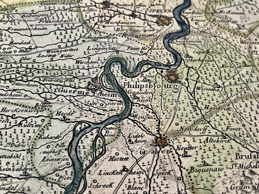
Henri Sengre's most remarkable work is his large synthetic map of the Upper Rhine region, composed of eight sheets, entitled "Oberrheinisches Kriegstheatrum" (Upper Rhine Theater of War). Published in 1692 by Alexis-Hubert Jaillot, this map, measuring 158 x 85 cm, surpasses its predecessors in the fineness of its topography. Its style served as a model for many contemporary and successive cartographers, such as Guillaume Delisle for his map of the course of the Rhine in 1704, or Nicolas de Fer.
Diversity of works and honorific titles
Beyond his large synthetic maps, Henri Sengre produced very specific documents, such as a geometric plan of the seigneury of Monte-Pilloy or a plan of the Chantilly forest for hunters. His titles vary according to the sources: he is mentioned as "Secretary and Geographer of H.R.H." (His Royal Highness) or simply cartographer. His catalog also includes maps of Alsace, Brisgau, the Black Forest, as well as detailed battle plans, such as that of Sinsheim, or the surroundings of the city of Strasbourg.