-
Old English nautical chart of New Zealand and the South Pacific
Regular price 60,00 €Regular priceUnit price per95,00 €Sale price 60,00 €Sold out -
Old English nautical chart of the central Red Sea
Regular price 60,00 €Regular priceUnit price per95,00 €Sale price 60,00 €Sale -
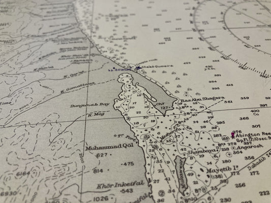
Old English nautical chart of the Southern Red Sea
Regular price 60,00 €Regular priceUnit price per95,00 €Sale price 60,00 €Sale -
Old nautical chart from Ouessant to the Loire
Regular price 65,00 €Regular priceUnit price per -
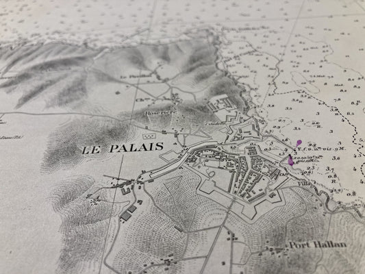
Old nautical chart of Belle-Île - Rade du Palais
Regular price 60,00 €Regular priceUnit price per -
Old nautical chart of Cérigo in Piraeus
Regular price 65,00 €Regular priceUnit price per -
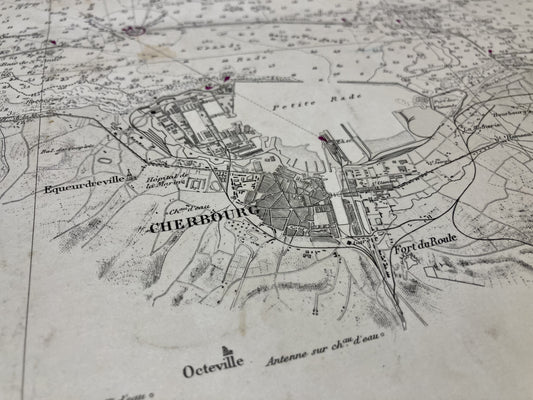
Old nautical chart from Cherbourg to La Hougue
Regular price 65,00 €Regular priceUnit price per -
Old nautical chart from Damietta to El-Arish
Regular price 65,00 €Regular priceUnit price per -
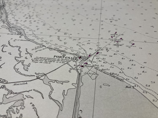
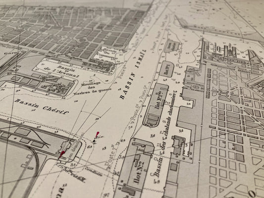
Old nautical chart of the entrance to the Suez Canal
Regular price 75,00 €Regular priceUnit price per -
Old nautical chart of Eastern Guernsey, Herm and Sark
Regular price 60,00 €Regular priceUnit price per -
Old nautical chart of the Island of Groix
Regular price 60,00 €Regular priceUnit price per -
Old nautical chart of Île Rousse
Regular price 90,00 €Regular priceUnit price per -
Old nautical chart from Île Rousse to Saint-Florent
Regular price 70,00 €Regular priceUnit price per -
Old nautical chart from Île Rousse to Saint-Florent
Regular price 65,00 €Regular priceUnit price per -
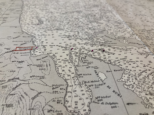
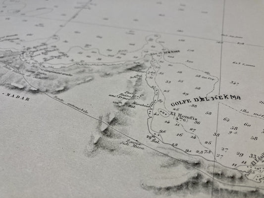
Ancient nautical chart of the Red Sea
Regular price 65,00 €Regular priceUnit price per -
Old nautical chart of the southern part of the Atlantic Ocean
Regular price 480,00 €Regular priceUnit price per -
Antique nautical chart of the western part of the Mediterranean Sea
Regular price 480,00 €Regular priceUnit price per -
Antique nautical chart of the northern part of the Atlantic Ocean
Regular price 520,00 €Regular priceUnit price per -
Old marine map from the Pointe de Trévignon to Lorient
Regular price 65,00 €Regular priceUnit price per -
Old nautical chart of the Cap Corse Peninsula
Regular price 70,00 €Regular priceUnit price per -
Old nautical chart from Lorient to Gironde
Regular price 60,00 €Regular priceUnit price per -
Old nautical chart from Port-Bail to the Pointe de Barfleur
Regular price 65,00 €Regular priceUnit price per -
Old nautical chart from Porto-Vecchio to Cape Pertusato
Regular price 65,00 €Regular priceUnit price per -
Old nautical chart of Ras Alam El Rum in Alexandria
Regular price 65,00 €Regular priceUnit price per