Antique maps of Pays de la Loire
Explore the geography of the region with my antique maps of Pays de la Loire. To go further, don't miss my collection of antique maps of the Centre. Perfect for collecting or decorating, for yourself or as a gift!
-
Old nautical chart of the Goulet de Fromentine to the Île d'Yeu
Regular price 70,00 €Regular priceUnit price / per -
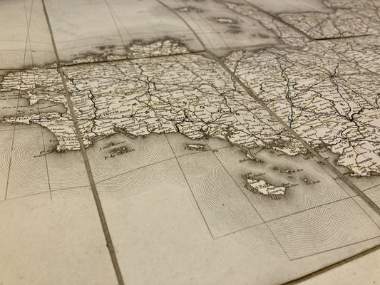
Old nautical chart from Ouessant to the Loire
Regular price 60,00 €Regular priceUnit price / per -
Old nautical chart of the harbor and Port du Croisic
Regular price 60,00 €Regular priceUnit price / per -
Old nautical chart from Lorient to Gironde
Regular price 60,00 €Regular priceUnit price / per -
Old nautical chart from Pointe de Saint-Gildas to Goulet de Fromantine
Regular price 60,00 €Regular priceUnit price / per -
Old nautical chart of Pointe du Grand-Mont in Le Croisic
Regular price 60,00 €Regular priceUnit price / per -
Old nautical chart from Ouessant to the Loire
Regular price 65,00 €Regular priceUnit price / per -
Old nautical chart of the entrance to the English Channel
Regular price 65,00 €Regular priceUnit price / per -
Old nautical chart from Croisic to Pointe de Saint-Gildas
Regular price 75,00 €Regular priceUnit price / per -
General Staff Map of Nogent-le-Rotrou and its surroundings
Regular price 100,00 €Regular priceUnit price / per -
Cassini map of Alençon and its surroundings
Regular price 100,00 €Regular priceUnit price / per -
Old road map of North-West France by Ch. Picquet
Regular price 140,00 €Regular priceUnit price / per -
Antin map of Thouarcé and its surroundings by Charles Blordier - 1873
Regular price 120,00 €Regular priceUnit price / per -
Antique map of Vihiers and its surroundings by Charles Blordier - 1873
Regular price 120,00 €Regular priceUnit price / per -
Antique map of Maine-et-Loire enhanced with watercolor by V. Levasseur
Regular price 60,00 €Regular priceUnit price / per
Bring a bit of the Atlantic Coast into your home with these antique maps of Pays de la Loire. This historic region of Anjou, rich in its landscapes and typical villages, offers real postcard settings. I offer you maps targeting specific areas, cities, or even an entire department like this antique illustrated map of Sarthe.
Choose which era of Pays de la Loire you would like to discover by immersing yourself in Cassini maps, General Staff maps or even old IGN maps.
Haven't found the old map of your dreams? Unfortunately, I may not have it in stock, so I invite you to discover my antique maps of Brittany, my antique maps of the Centre or those of Poitou-Charentes. If it is only the Pays de la Loire that you are looking for, do not hesitate to explore my antique maps of the Loire-Atlantique, that beautiful antique illustrated map of Vendée or my beautiful antique maps of Maine-et-Loire.


