Gerardus Mercator, 16th-century cartographer and scholar
Gerard Mercator was born in 1512 in Rupelmonde, in the County of Flanders. He studied at the University of Louvain where he trained in mathematics, astronomy and geography. There he developed a rigorous scientific approach to cartography, combining observation, calculation and engraving.
Early maps, globes and scientific works
From the years 1530, Mercator produced his first maps and geographical instruments. He published a globe in 1541 followed by a celestial globe in 1551. These works, which met with widespread success, helped to establish his reputation across Europe. They demonstrated his technical mastery and his ambition to offer a more coherent and accurate representation of the world.
The inventor of modern scientific cartography
Gerardus Mercator, born in Flanders in 1512, established himself as the most influential mathematician and geographer of the Renaissance. Trained at the University of Leuven, he perfected the art of copperplate engraving and the manufacture of scientific instruments. In 1569, he published his famous world map using the Mercator projection, a major technological innovation that allowed navigators to plot straight-line routes (loxodromes) on a flat surface. This advancement not only transformed maritime exploration but remains the foundation of most nautical charts to this day.
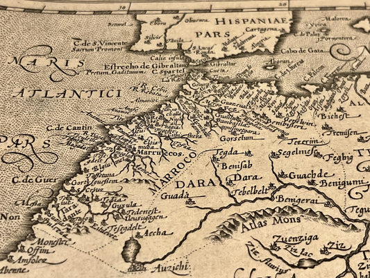
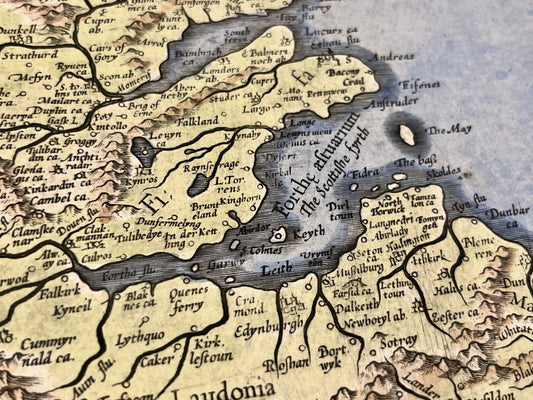
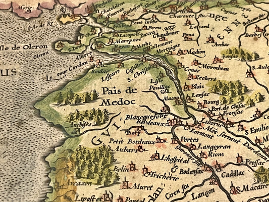
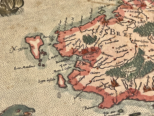
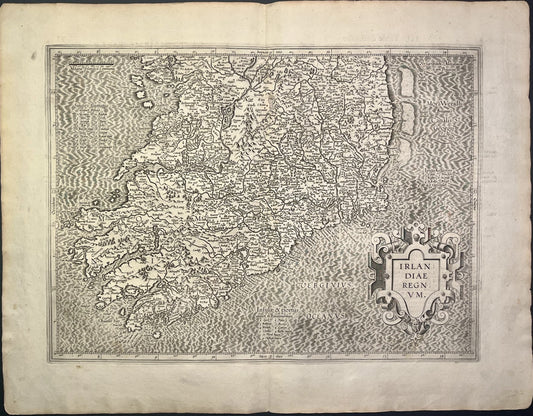
The Birth of the Atlas: A Cosmographic Vision
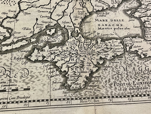
Mercator was the first to use the term "Atlas" to refer to a collection of maps, in homage to the mythological king of Mauritania and not to the Titan who carried the world. His project was colossal: a comprehensive cosmographical work describing the creation and history of the universe. Although he published parts of his atlas as early as 1585 and 1589, the complete work was not finalized and published by his son Rumold until 1595, a year after his death. His maps are distinguished by their exceptional clarity and the systematic use of italic script for nomenclature, a style he himself widely popularized.
The legacy of the work and its influence on the Dutch Golden Age
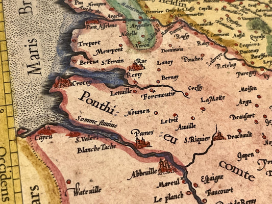
Although Mercator produced masterpieces such as his map of Europe or his edition of the Geography of Ptolemy, his influence endured well beyond his lifetime thanks to the purchase of his copper plates by Jodocus Hondius. In 1604, this acquisition led to the creation of the Mercator-Hondius Atlas, disseminating its geographical knowledge throughout the world. Today, Mercator's original maps are among the most precious and symbolic pieces for any collector, representing the definitive transition from medieval cartography to modern geographical science.