-
Antique map of Limburg - Belgium - by J. Blaeu - ca. 1650
Regular price 180,00 €Regular priceUnit price per -
Antique map of Catholic Belgium by the Homann Heirs - ca. 1740
Regular price 190,00 €Regular priceUnit price per -
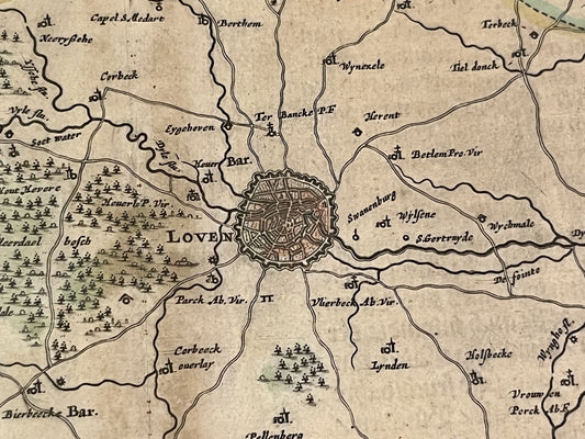
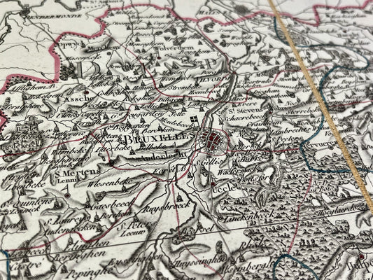
Antique map of Brabant - Leuven - by J. Janssonius - ca. 1640
Regular price 190,00 €Regular priceUnit price per -
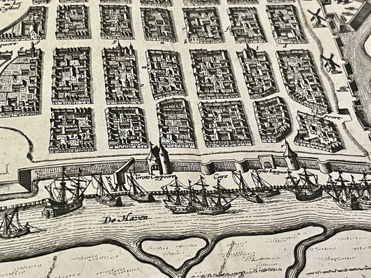
New Monumental Plan of the City of Antwerp – 1910
Regular price 195,00 €Regular priceUnit price per -
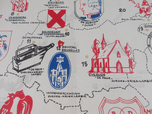
Map of Special Regional Beers of Belgium - 1954
Regular price 199,00 €Regular priceUnit price per -
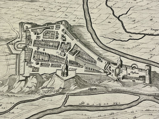
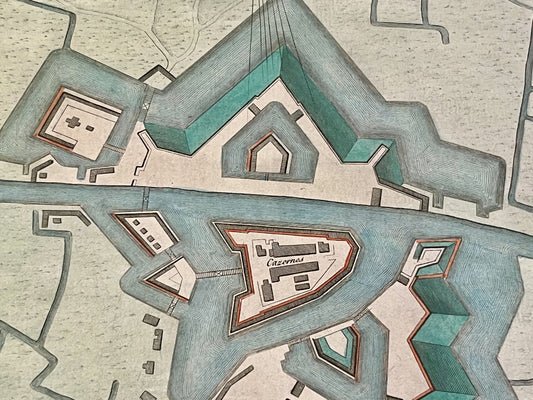
Antique map of the Fort of Knokke - Belgium - by GL Le Rouge - ca. 1740
Regular price 200,00 €Regular priceUnit price per -
Daily Mail Aerial Map of the Western Front - ca. 1940
Regular price 202,00 €Regular priceUnit price per -
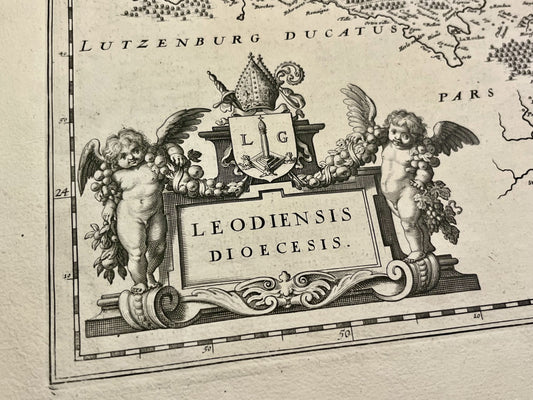
Antique map of the Diocese of Liège by W. and J. Blaeu - ca. 1630
Regular price 210,00 €Regular priceUnit price per -
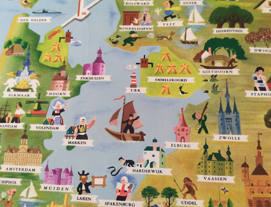
Illustrated tourist poster of the Benelux countries - ca. 1950
Regular price 210,00 €Regular priceUnit price per -
Antique map of the Duchy of Limburg by G. Blaeu and J. Blaeu - ca. 1640
Regular price 220,00 €Regular priceUnit price per -
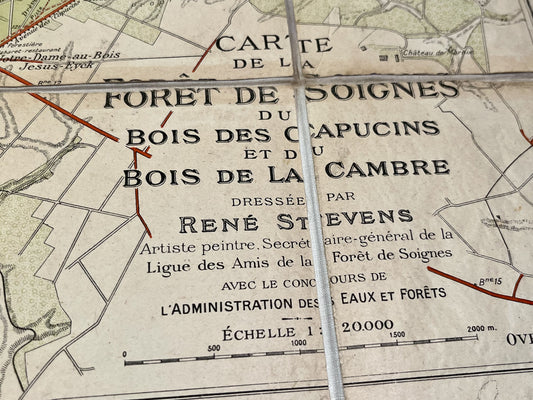
Antique map of the Sonian Forest and Tervueren Park by R. Stevens
Regular price 220,00 €Regular priceUnit price per -
Antique map of Nieuport - Belgium - by V. de Plouich - ca. 1640
Regular price 220,00 €Regular priceUnit price per -
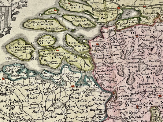
Antique map of East Flanders by F. de Wit - ca. 1640
Regular price 240,00 €Regular priceUnit price per -
Antique map of the Dyle department by PG Chanlaire - ca. 1820
Regular price 240,00 €Regular priceUnit price per -
Antique map of the Escaut department by PG Chanlaire - ca. 1820
Regular price 240,00 €Regular priceUnit price per -
Antique map of the Forêts Department by PG Chanlaire - ca. 1820
Regular price 240,00 €Regular priceUnit price per -
Antique map of the department of Jemappes by PG Chanlaire - ca. 1820
Regular price 240,00 €Regular priceUnit price per -
Antique map of the Lys department by PG Chanlaire - ca. 1820
Regular price 240,00 €Regular priceUnit price per -
Antique map of the Meuse Inférieure by PG Chanlaire - ca. 1820
Regular price 240,00 €Regular priceUnit price per -
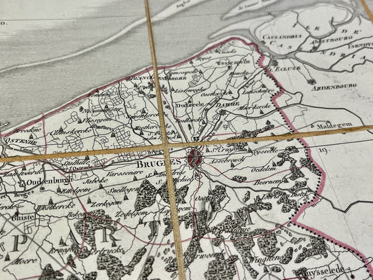
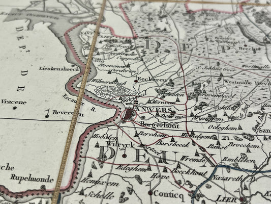
Antique map of the Deux-Nèthes department by PG Chanlaire - ca. 1820
Regular price 240,00 €Regular priceUnit price per -
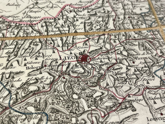
Antique map of the Ourte department by PG Chanlaire - ca. 1820
Regular price 240,00 €Regular priceUnit price per -
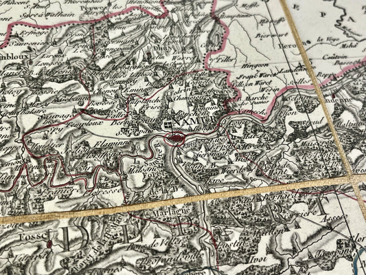
Antique map of the department of Sambre-et-Meuse by PG Chanlaire - ca. 1820
Regular price 240,00 €Regular priceUnit price per -
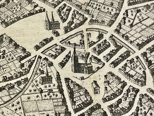
Antique map of Tirlemont - Belgium - by J. Blaeu - ca. 1650
Regular price 240,00 €Regular priceUnit price per -
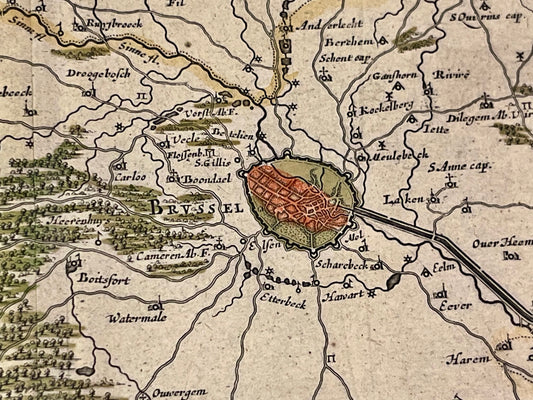
Antique map of Brabant - Brussels - by W. Blaeu - ca. 1640
Regular price 250,00 €Regular priceUnit price per